A hot, dry summer
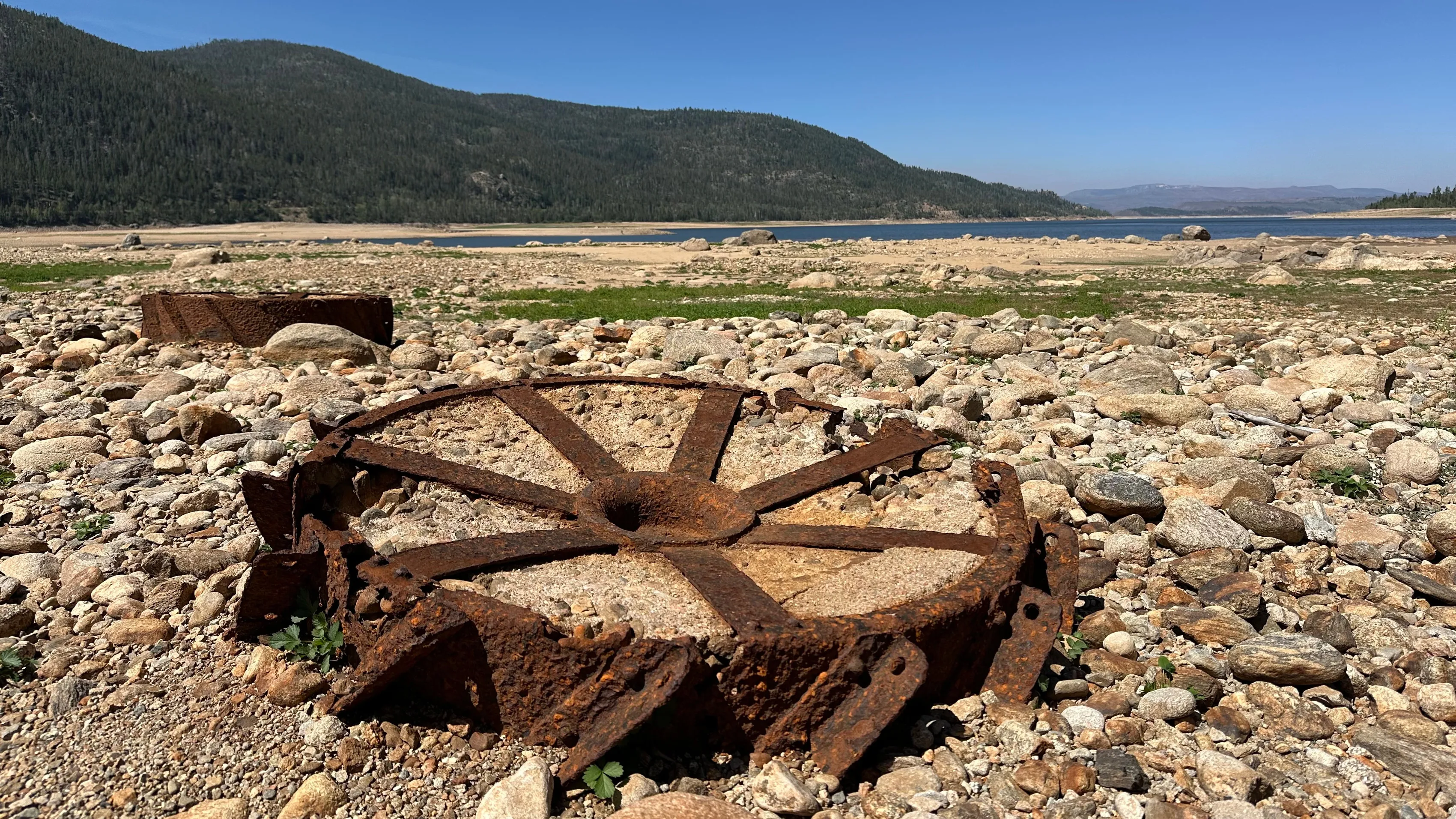
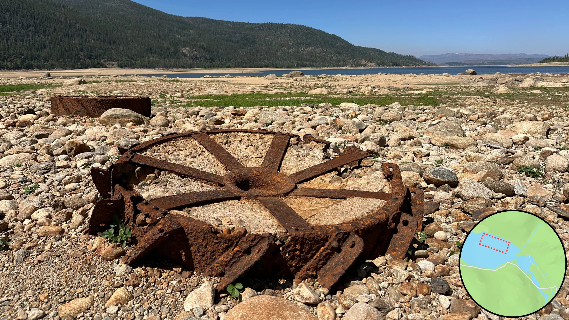
The opener of Follow the Water: a rusted spoked iron wheel lying in the cobbles of the exposed lakebed, with the remaining water and the forested ridge behind it. It states the subject at once, what the falling water uncovered.
Follow the Water
My family camps over my birthday each summer. This year we returned to Arapaho Bay on Lake Granby, where we had camped 6 years before. The water had fallen far enough to walk out across the lakebed, and there we found Monarch, a mining town that went bust and was flooded when the Bureau of Reclamation built the Colorado-Big Thompson Project. The next day I built a quick app with Claude to explore it, then a presentation following the water from that lake to the people who depend on it.
Lake Granby
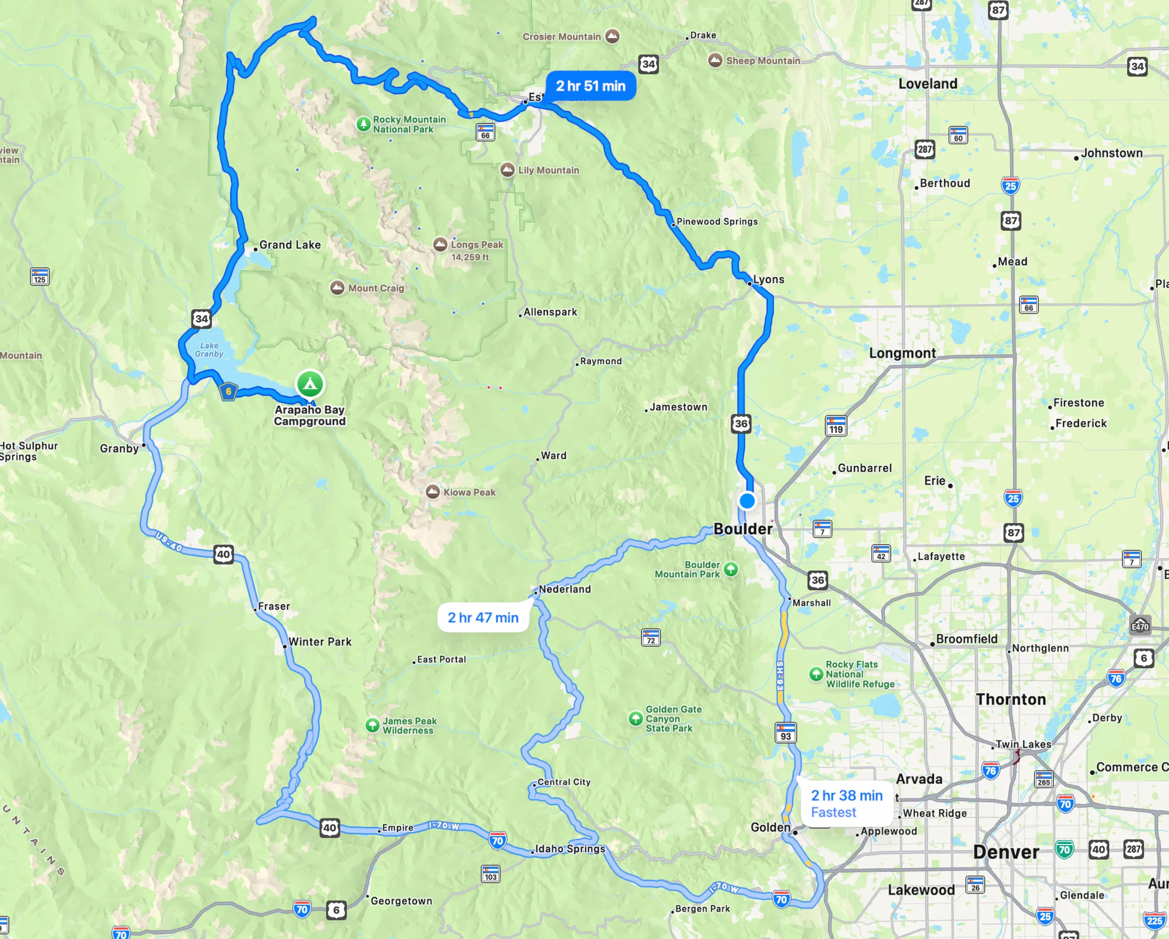
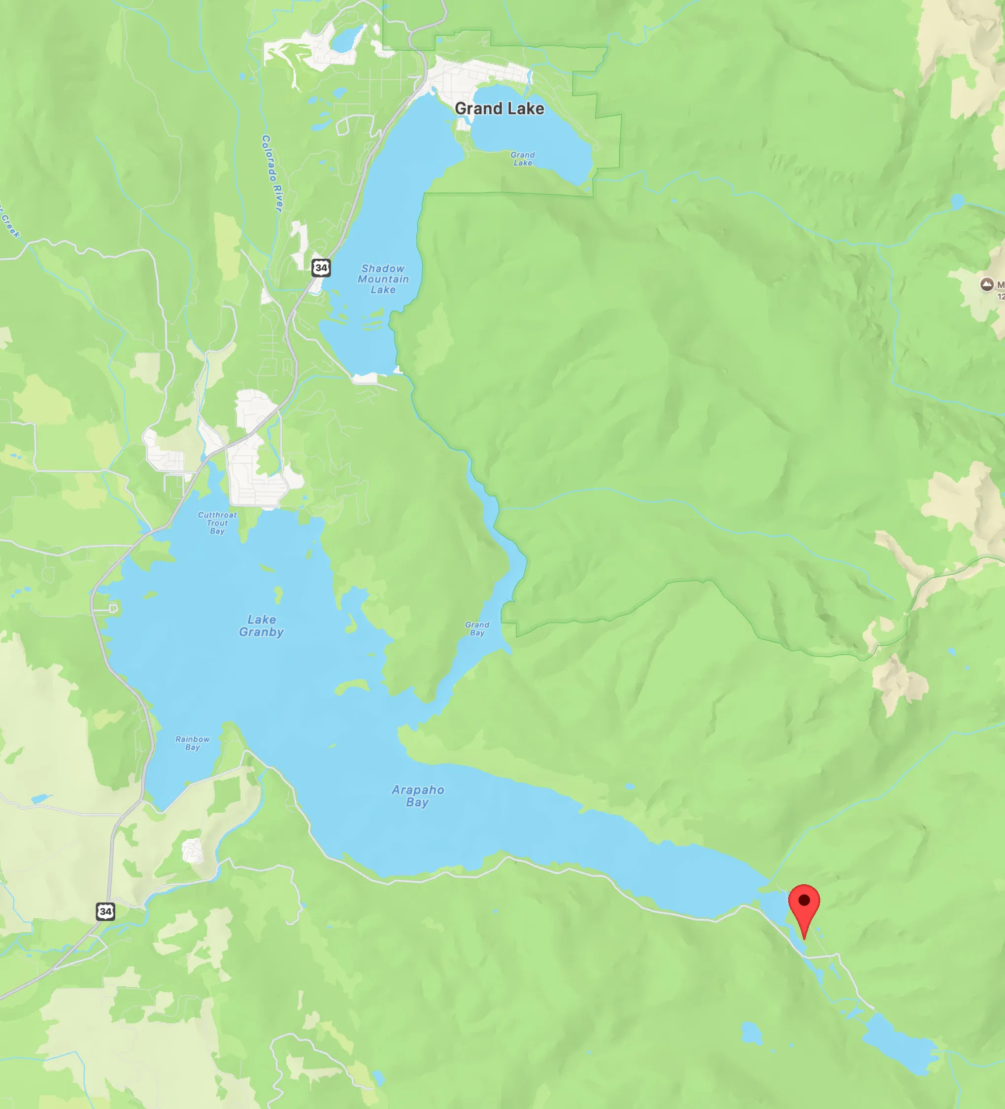
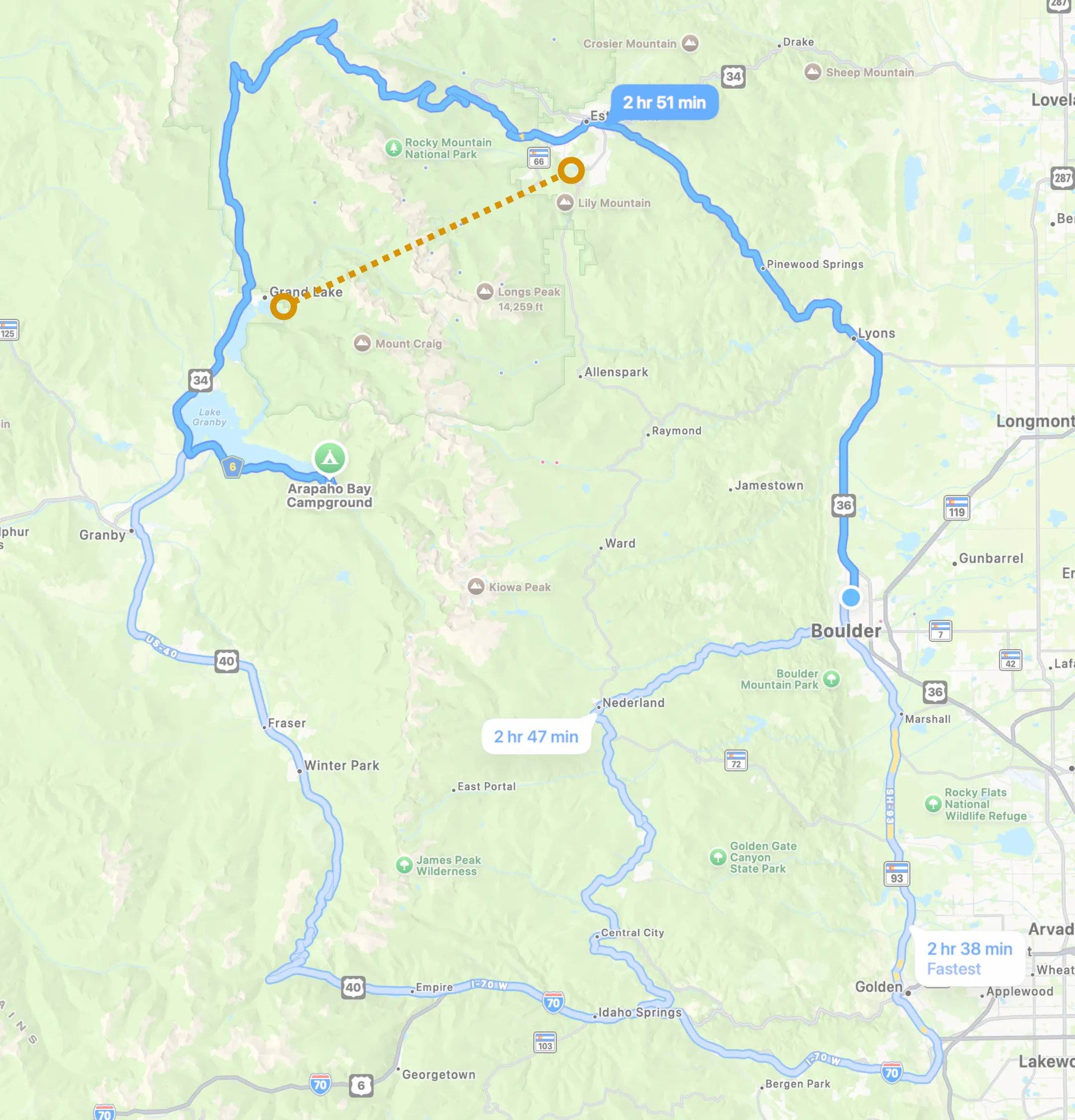
The way there: the drives around the mountains between the Front Range and Lake Granby, then the lakes themselves with a pin at the camp on Arapaho Bay. It sets out the geography the page returns to.
June 20, 2020
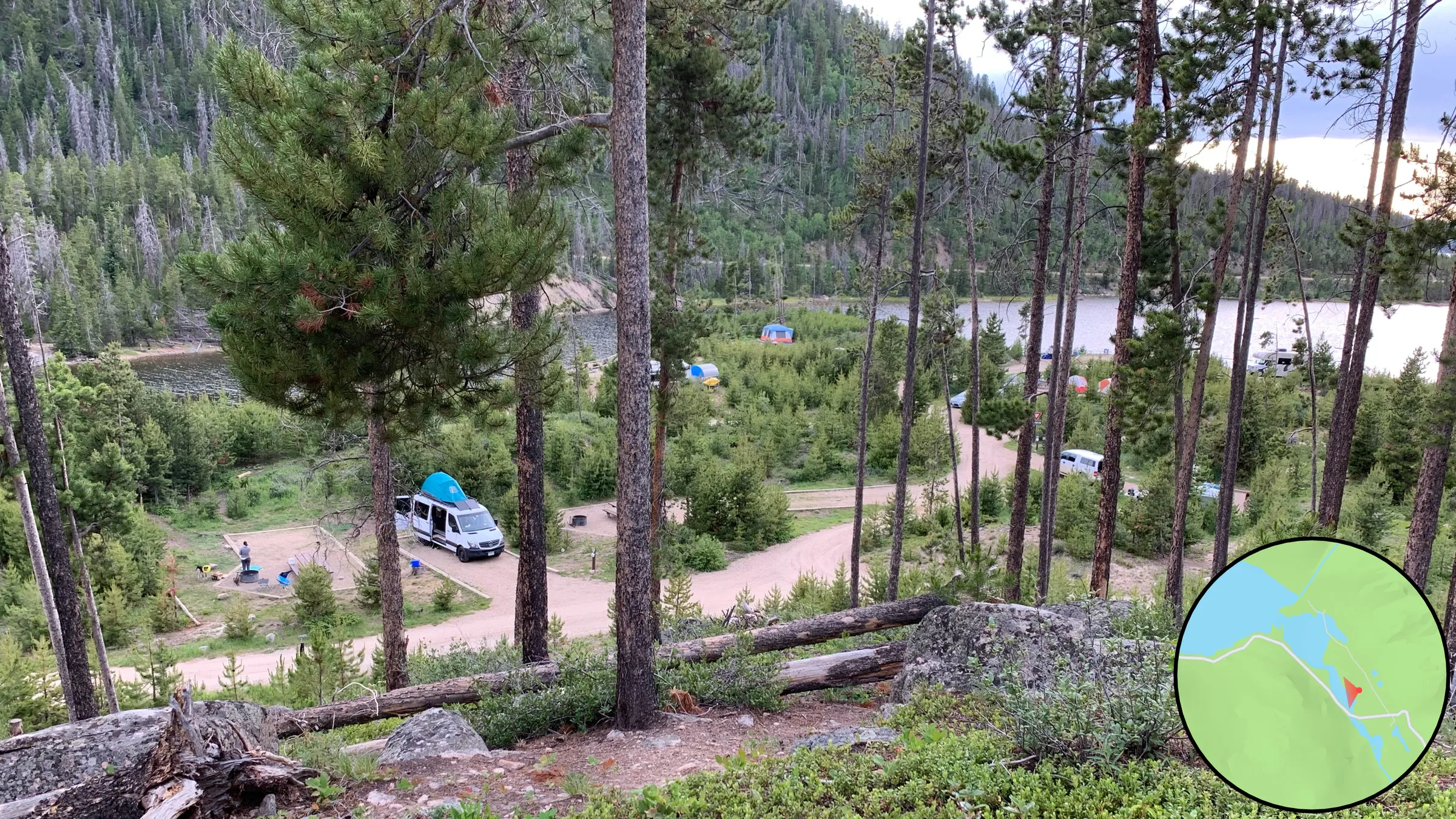
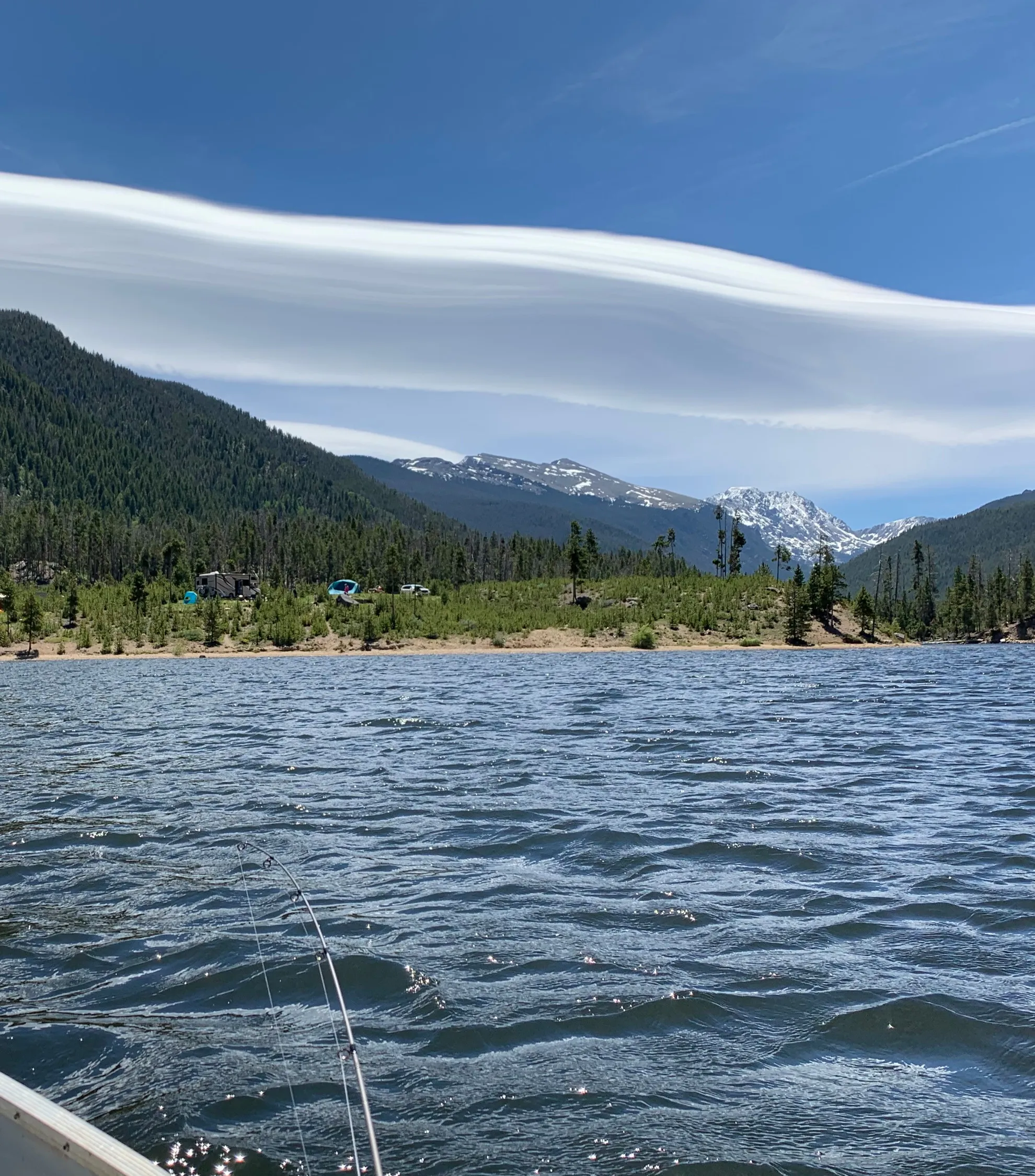
The first camping trip at Lake Granby, 6 years before: the same camping spot, canoeing, fishing, and the beach, with the lake as full as anyone would expect.
This story starts at our first camping trip 6 years ago, oddly with the van in the exact same camping spot. We canoed, fished, and splashed at the beach. The lake was exactly as you would expect.
Four views of Lake Granby full, in June 2020: the camp above the water, a sunset, the bay from a canoe, and a person and a dog at the water's edge. Each carries a locator map. They establish the water level that the August 2026 photographs are measured against.
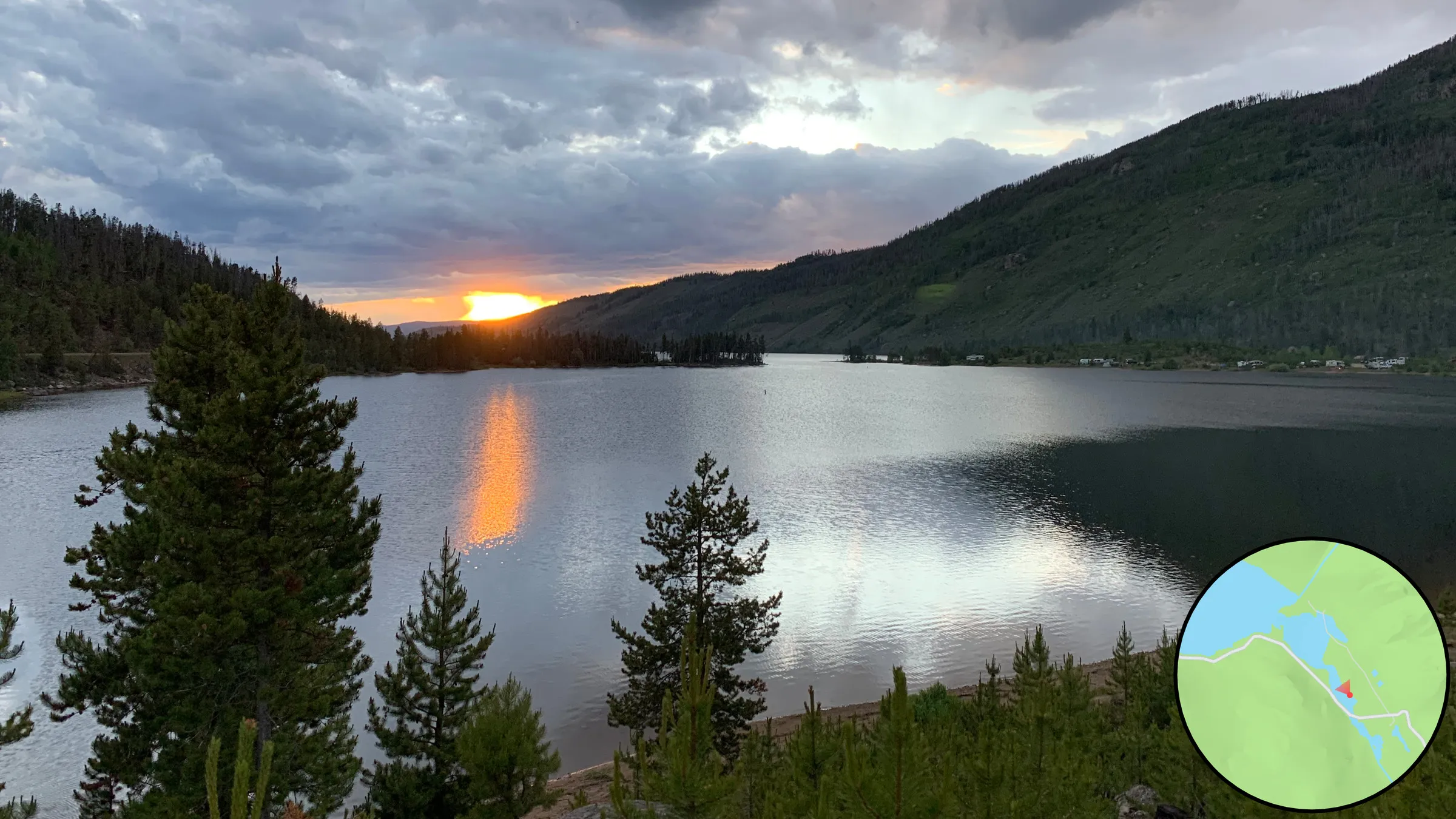
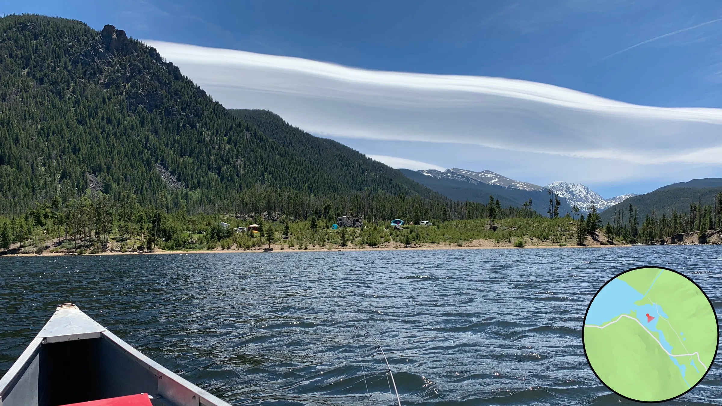
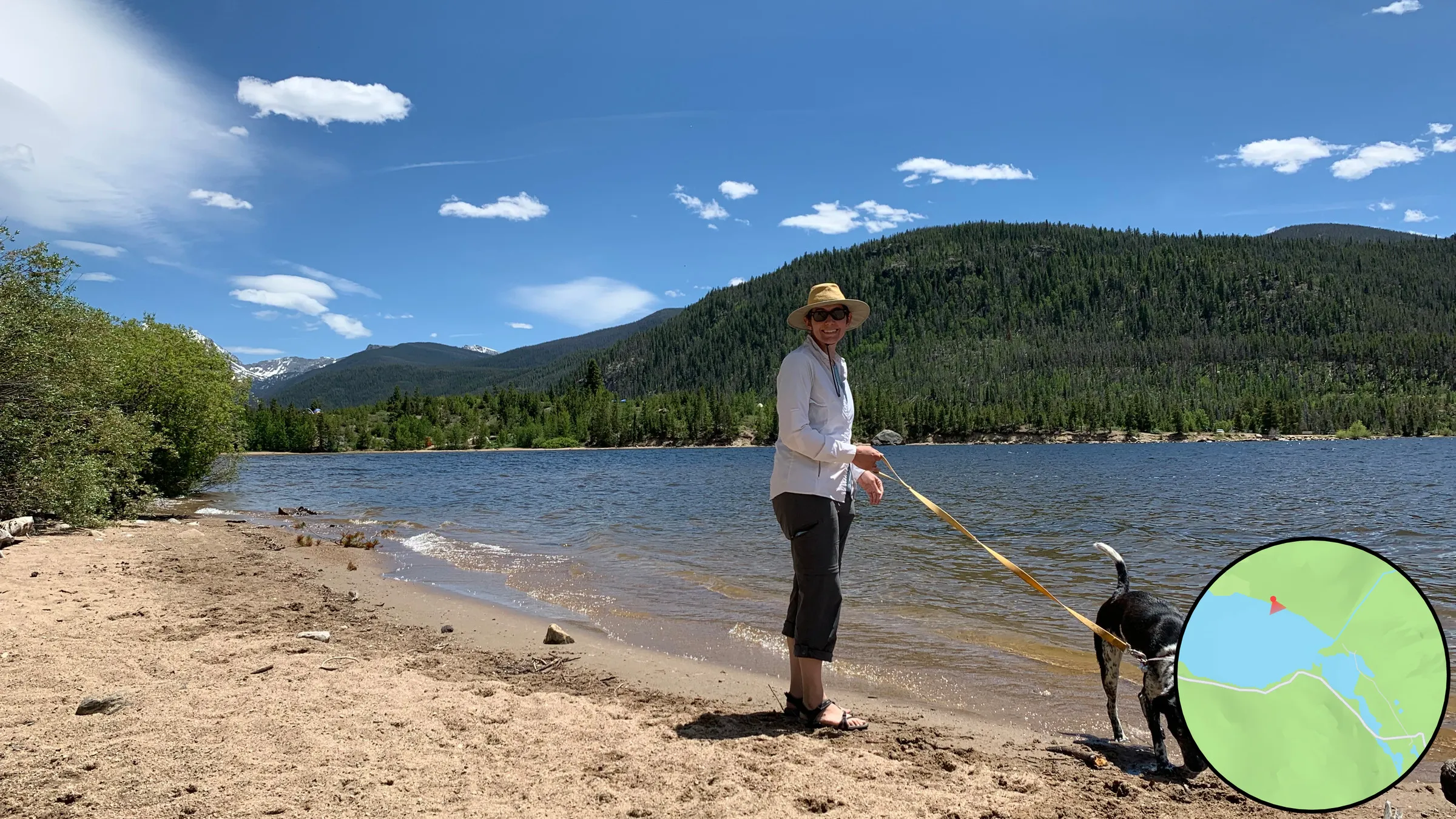
June 20, 2020
~1905
A view over the town of the Monarch Consolidated Gold and Copper Mining and Smelting Company in 1905, before Lake Granby was dammed, with the locator map marking where it stood on Arapaho Creek. The text says what the town had and how it went bust.
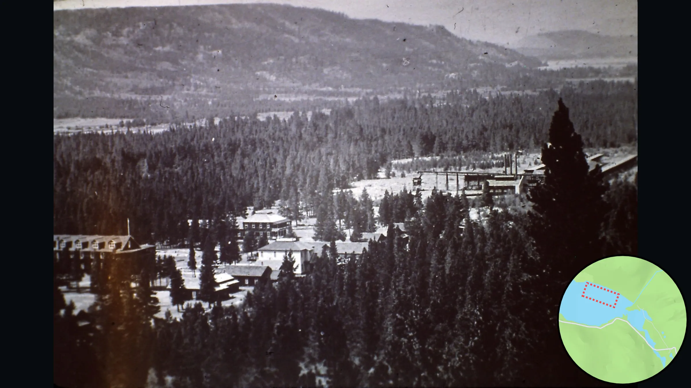
But in 1905, Lake Granby had not yet been dammed and there existed a small town called the Monarch Consolidated Gold and Copper Mining and Smelting Company on the bank of Arapaho Creek. The town had a railroad, cottages, a hotel, stores, a bowling alley, a theater, and a dance hall. The mine produced only $150 in copper per year, the box factory burned down, and the town slowly went bust.
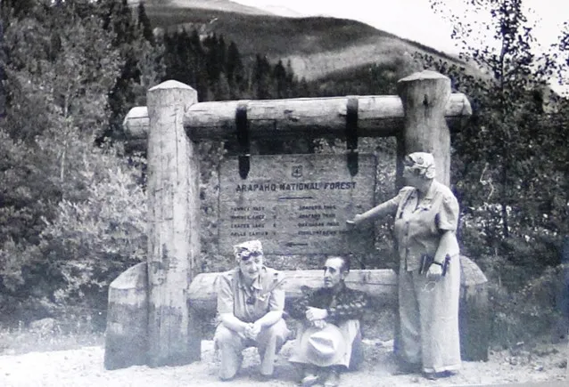
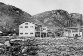
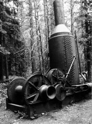
Three photographs of the town and what it left: people at a national forest sign, the works, and machinery abandoned in the forest.
1941–1950
The Bureau of Reclamation's illustrated map of the Colorado-Big Thompson Project, beside the account of how the project dammed Lake Granby and put the remains of Monarch underwater.
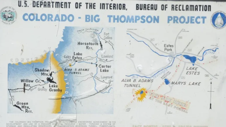
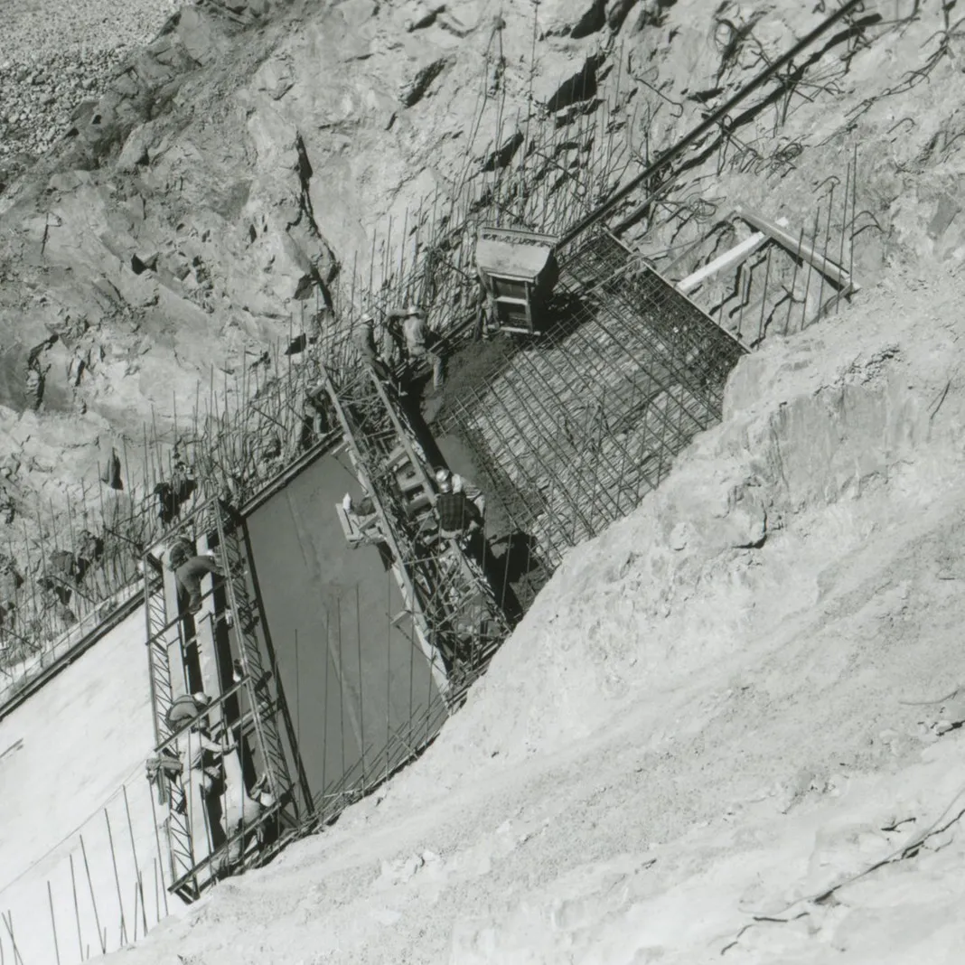
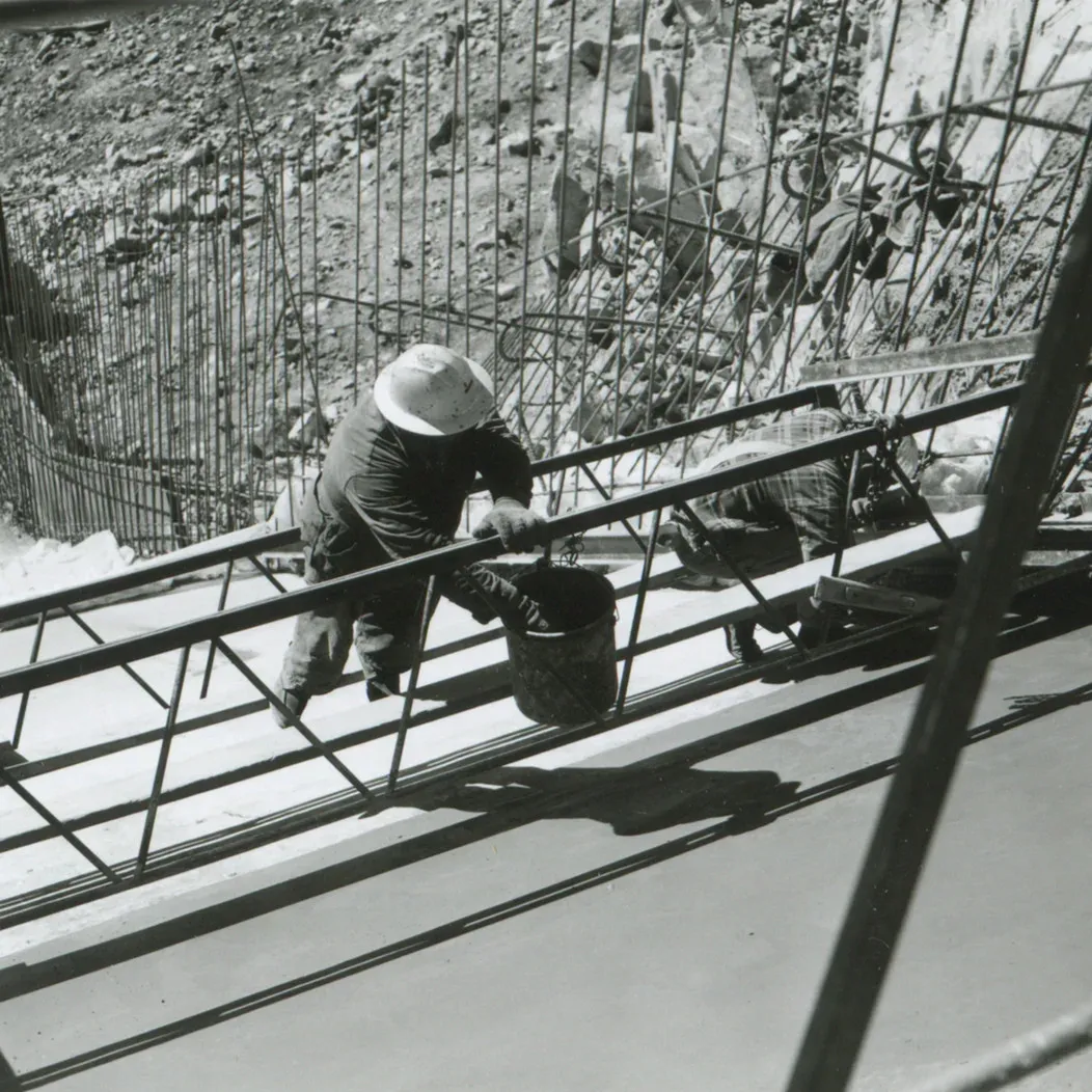
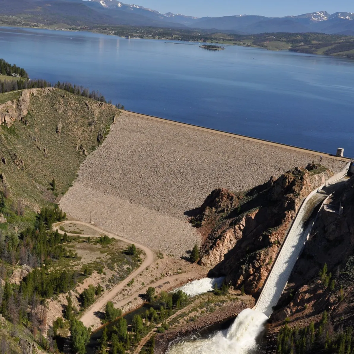
In the early 1940s the US Department of the Interior began the Colorado-Big Thompson Project, whose goal was to manage water resources on the Western Slope of the Rockies. Lake Granby was dammed to create a working reservoir, and the remains of the town of Monarch disappeared underwater.
CreditMap: U.S. Department of the Interior, Bureau of Reclamation.
Building Granby Dam: formwork on a steep excavated slope, a worker in a pith helmet at a railing, and the finished dam with water running down its spillway into the Colorado River.
The tunnel: the road map with a dotted line straight through the mountains the drive goes around, beside 4 photographs of the work, a crew riding out on a narrow rail car, a drill at the face, men shaking hands through the holing-through, and the finished bore. The caption says what it took: two teams, 13 miles under Rocky Mountain National Park, meeting to within an inch.
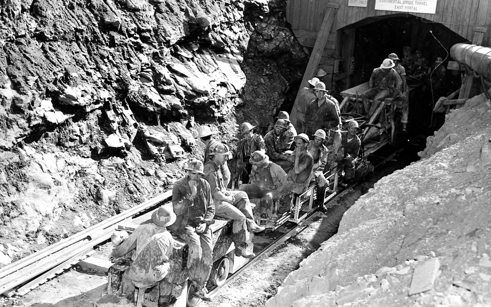
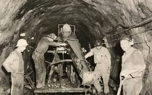
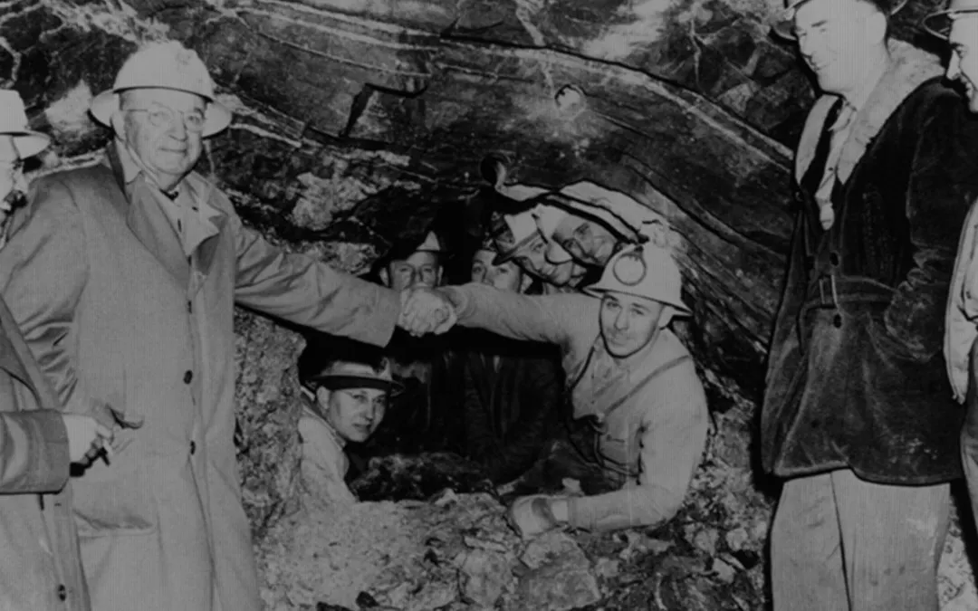
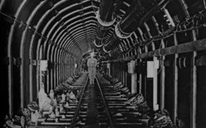
From the Colorado River
A clip from the film Rivers of the Rockies, in which Nick stands on the shore of the reservoir and tells the story of the Alva B. Adams Tunnel, the 13 miles under the Continental Divide that the page has just shown being dug. It opens the section on where the water goes.
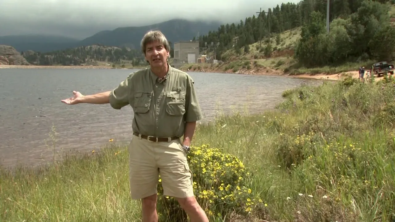 Video, 2:54
Text equivalent: In this clip from "Rivers of the Rockies", Nick tells us about the Alva B. Adams Tunnel - one of the most remarkable engineering accomplishments of all time.
The Colorado River basin from source to Mexico, with the Granby system drawn out in a circle: the tunnel, the dams, pumping, and the camp site. Beneath it, what the river supplies: about 40 million people, about 5.5 million acres of irrigated crops, and about 1,600 megawatts.
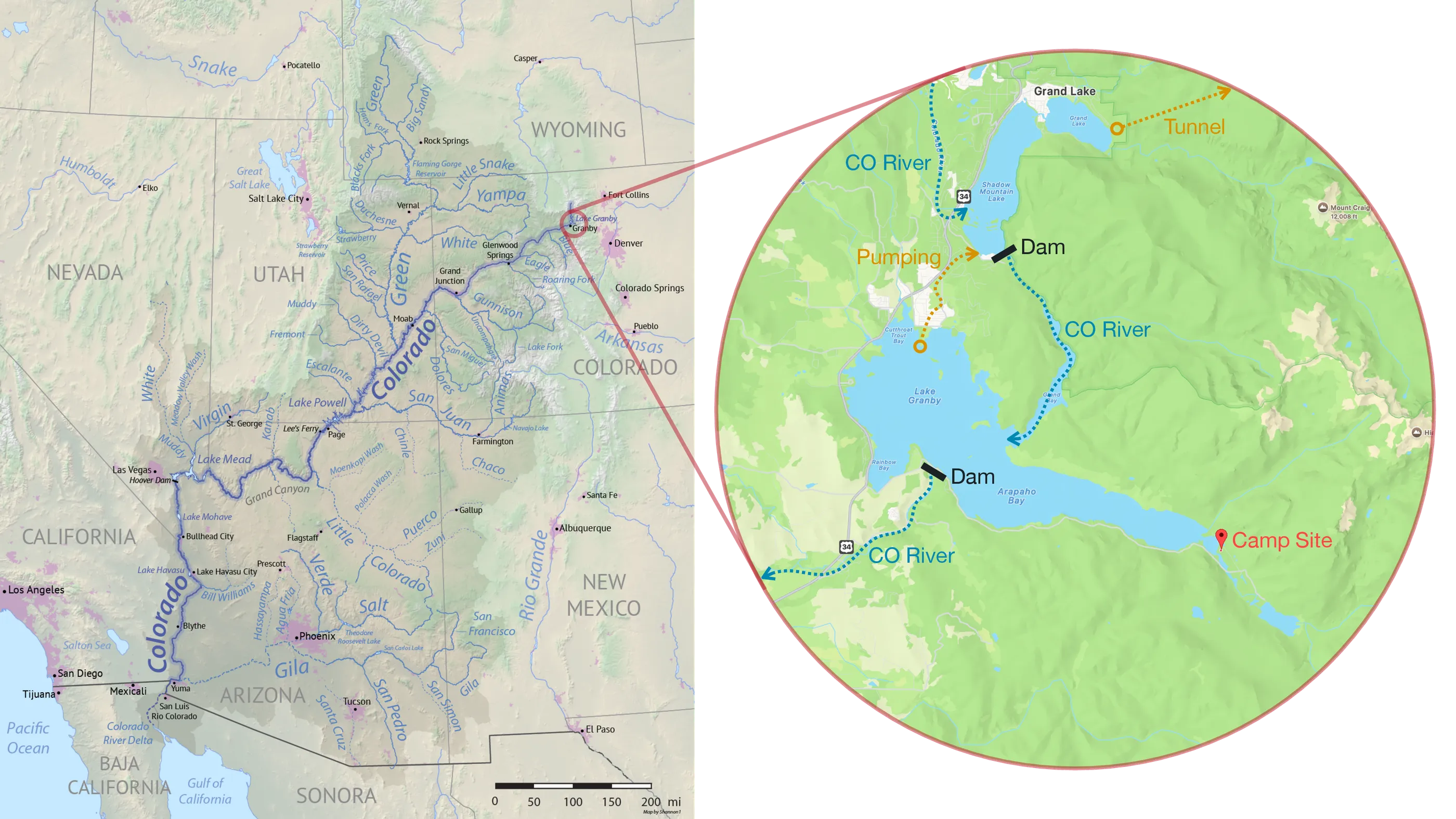
Municipal
~40m people
Los Angeles, San Diego, Phoenix, Tucson, Albuquerque, Tijuana
Irrigation
~5.5m acres
Lettuce, spinach, broccoli, onions, carrots, cauliflower, herbs, kale
Energy
~1,600 MW
4 dams supplying electricity for ~700,000 people
CreditBasin map: Shannon1, CC BY-SA 4.0.

The reach of the river in one sentence: the winter salads of the whole country depend on it.
The river supplies every American eating a salad between November and March.
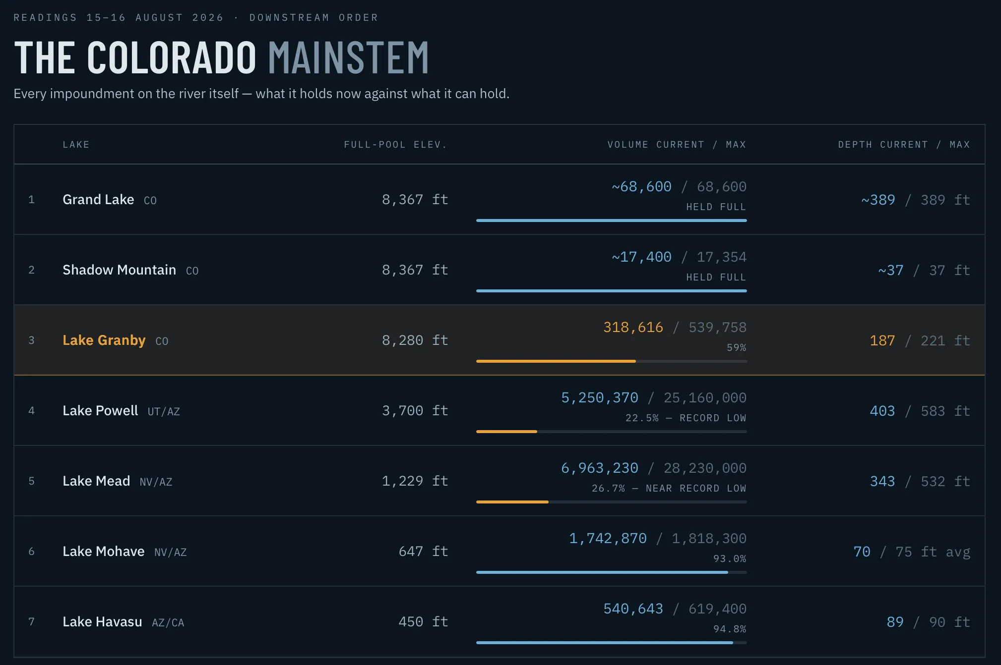
A table of every impoundment on the Colorado's mainstem in downstream order, read on 15–16 August 2026, setting what each holds against what it can hold. Lake Granby is highlighted at 59 percent; Lake Powell and Lake Mead are marked at or near record lows.
August 6, 2026
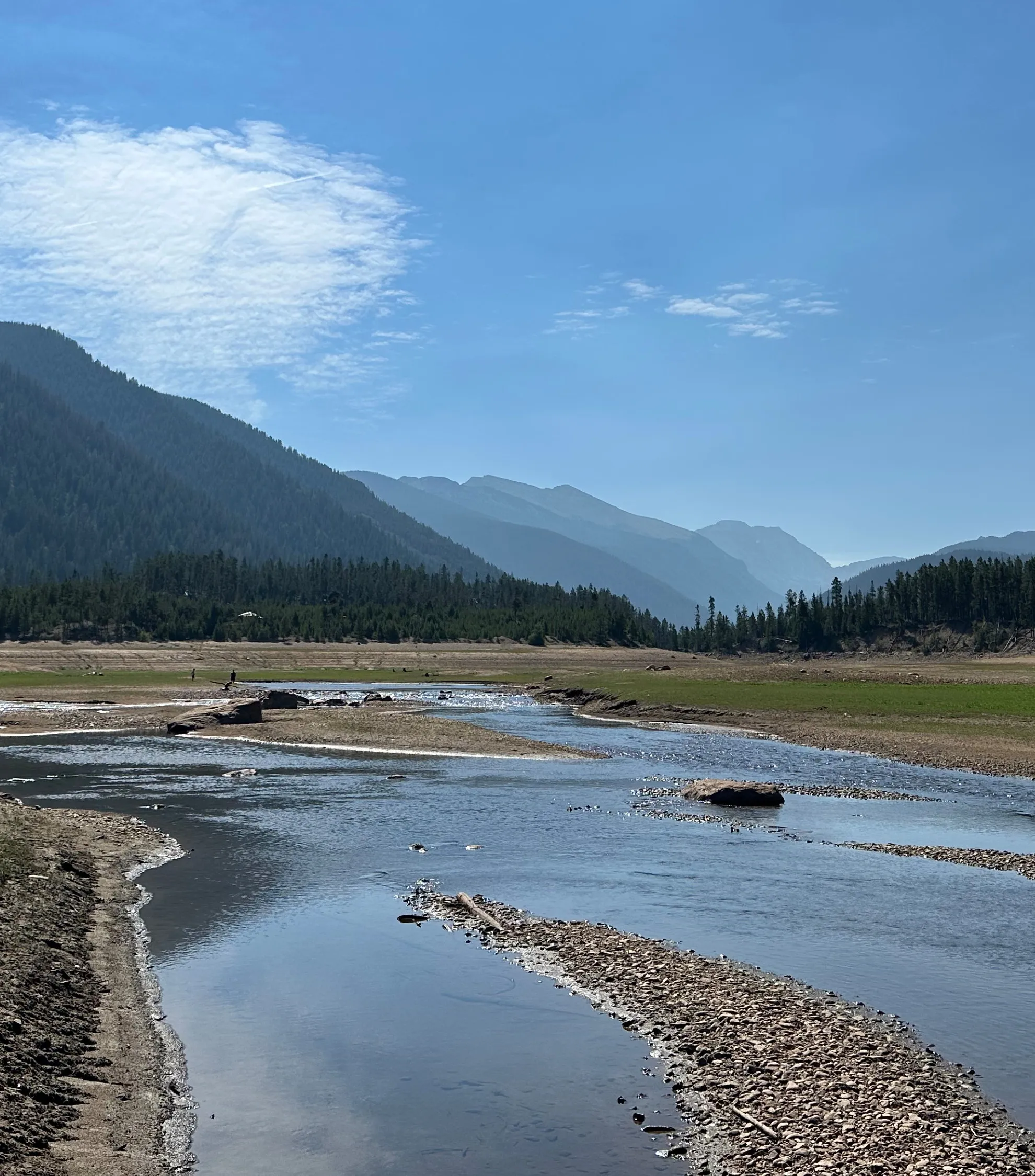
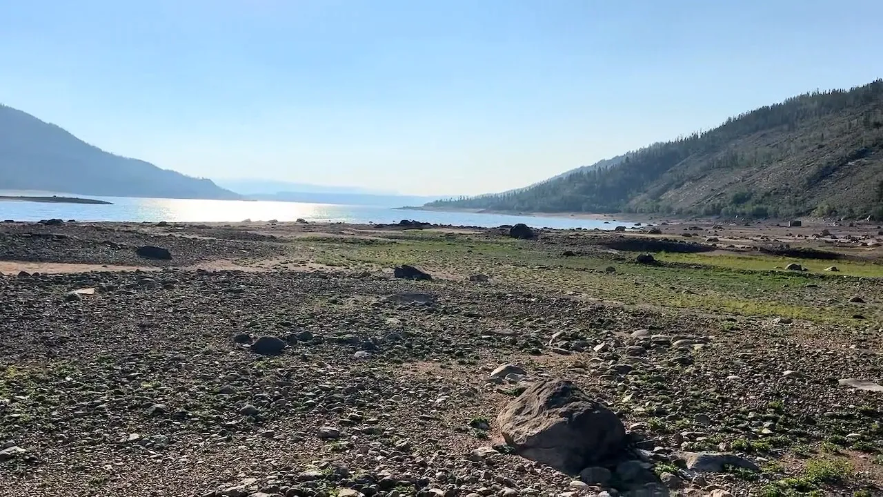
The bay six years on: where the canoe floated in 2020, a shallow river now braids across bare lakebed.
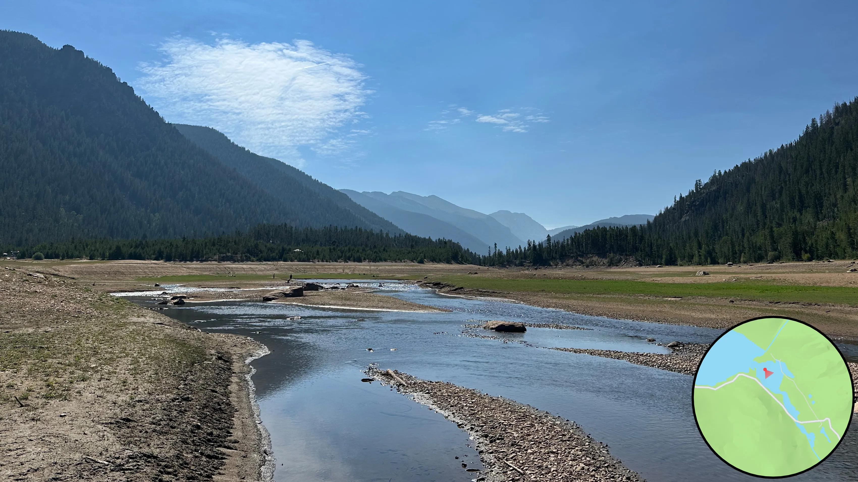
The same view of the same valley, side by side: a full lake in June 2020 and a river over bare lakebed in August 2026.
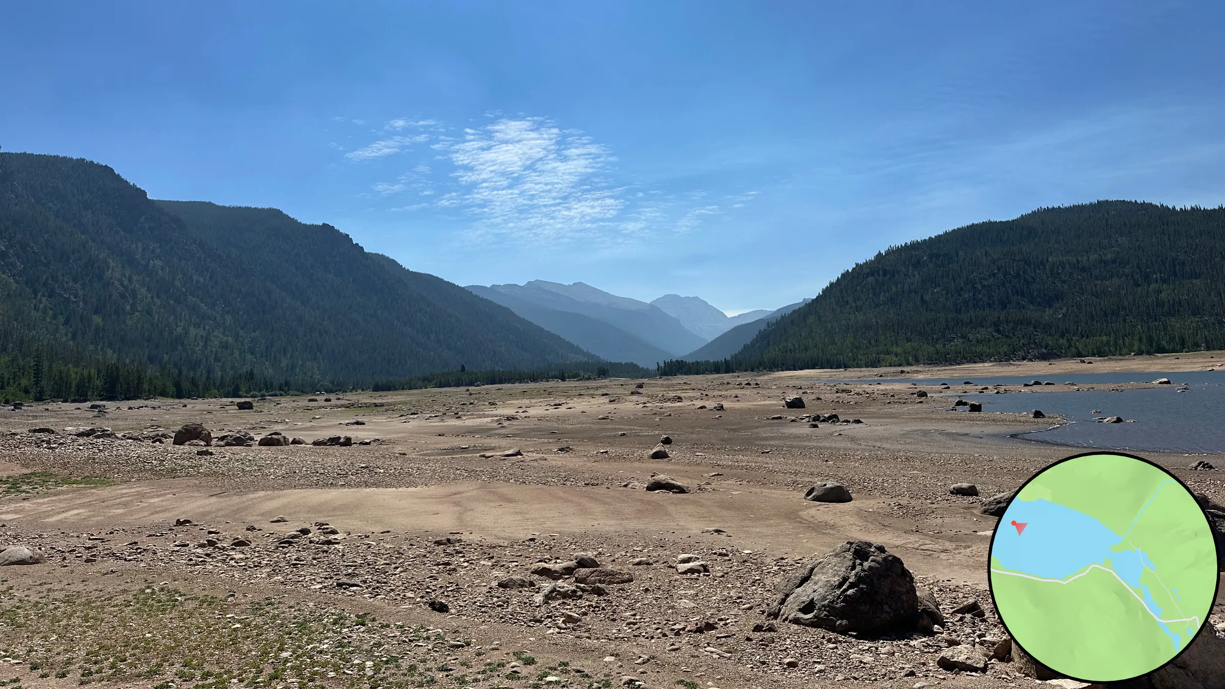
Walking the exposed lakebed: lines of stone marking out shapes in the silt and a rusted spoked iron wheel in the cobbles, each photograph placed by its locator map at the old townsite.
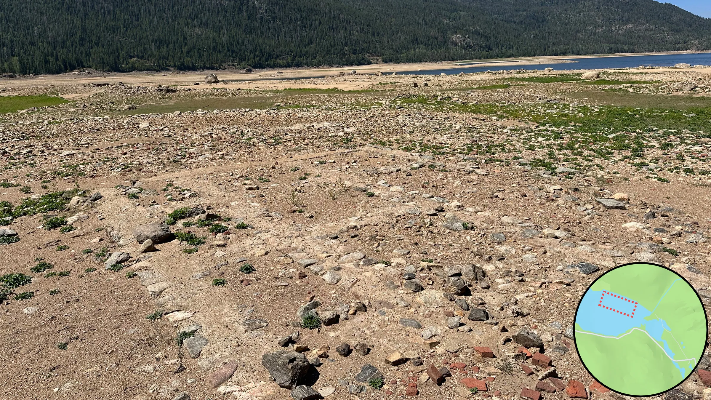
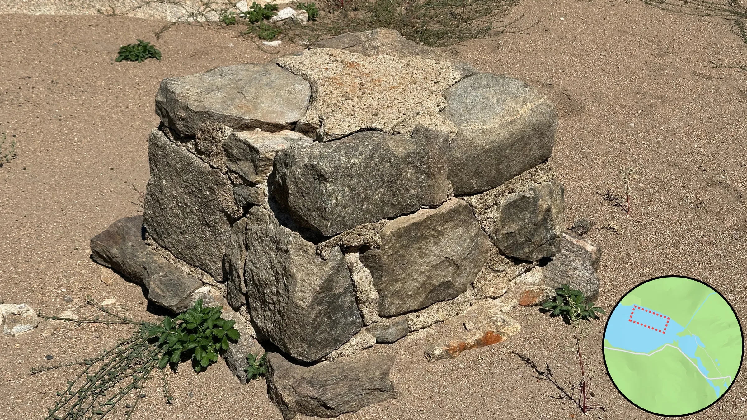
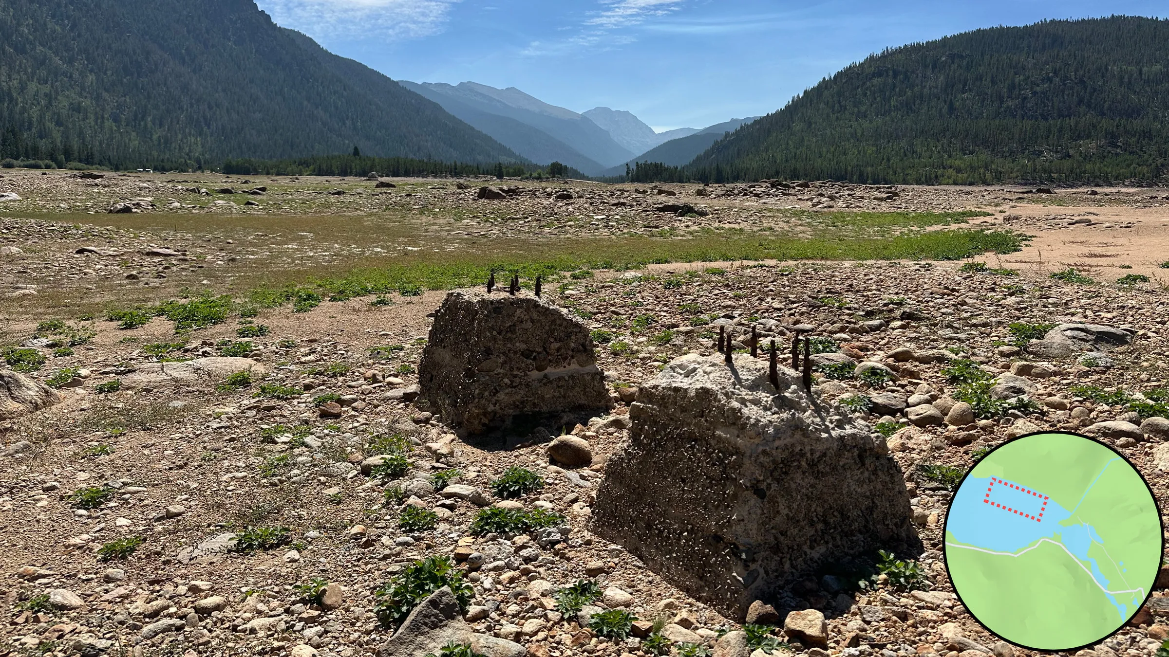
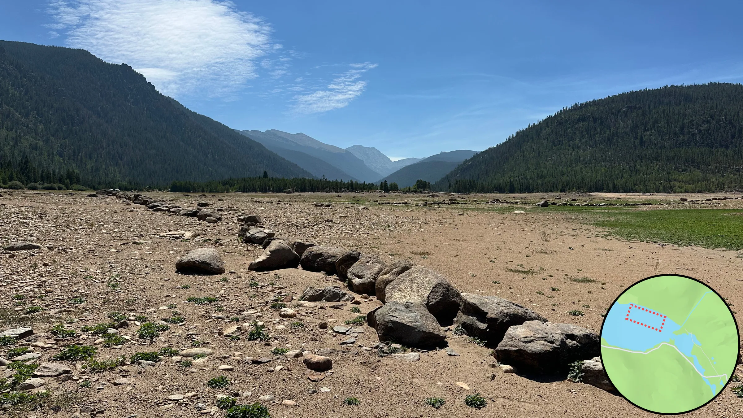
More of what stands on the lakebed: a mortarless pier of fitted stone, two blocks with iron bolts standing out of them, and two long lines of stones laid across the silt, the plan of something built showing through.
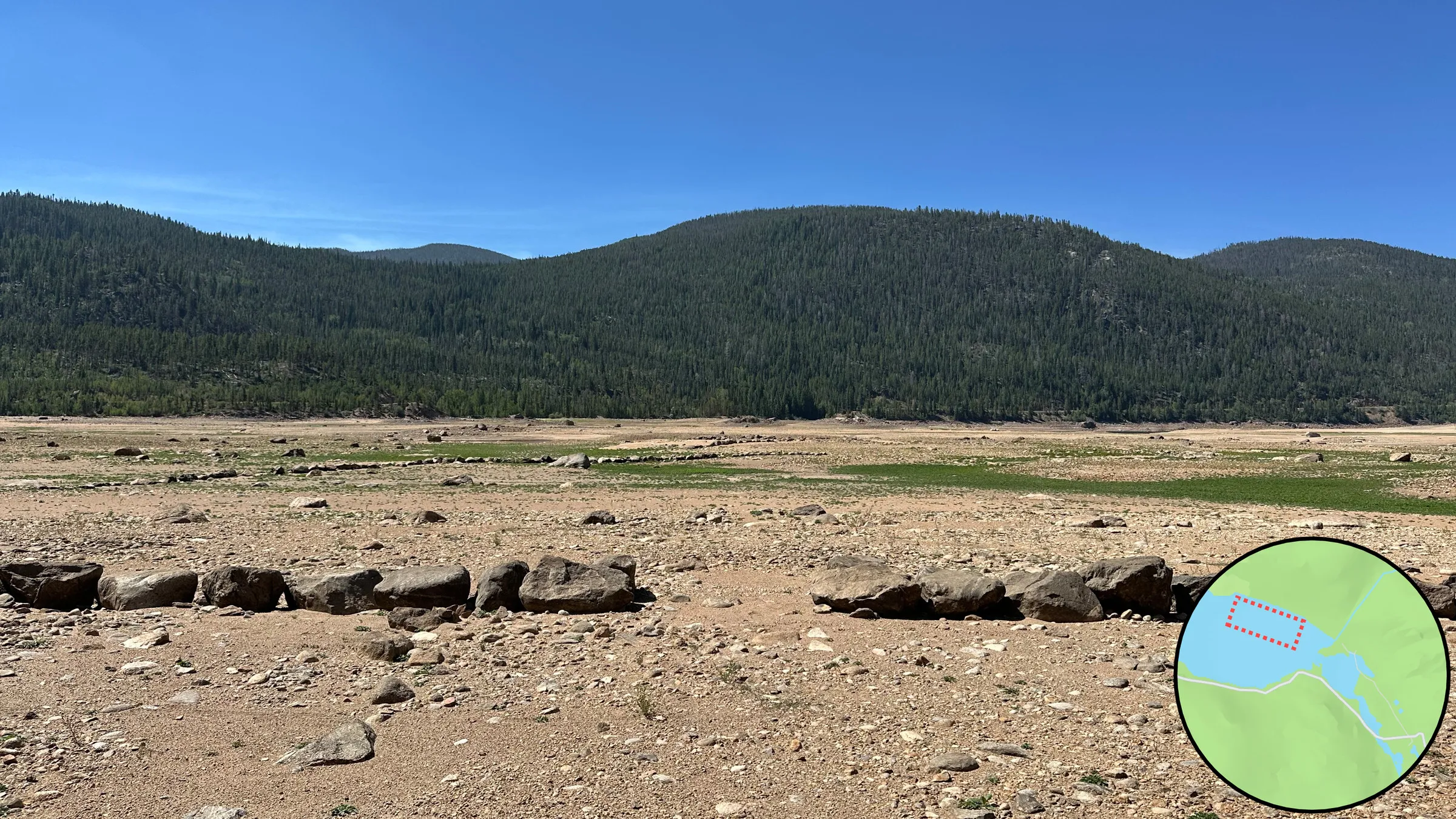
A 39-second silent pan across the exposed lakebed, from the remaining water around a wide bare valley floor of silt, cobbles and low green growth to the forested ridge. It gives the scale that the single photographs cannot.
 Video, 0:39
Text equivalent: A silent pan across the exposed lakebed. It starts with the remaining water at far left and a boulder in the foreground, sweeps past a steep slope of rock and scattered trees above a wide floor of pale silt, cobbles and patches of green, and ends on a dark forested ridge with a strip of water below it.
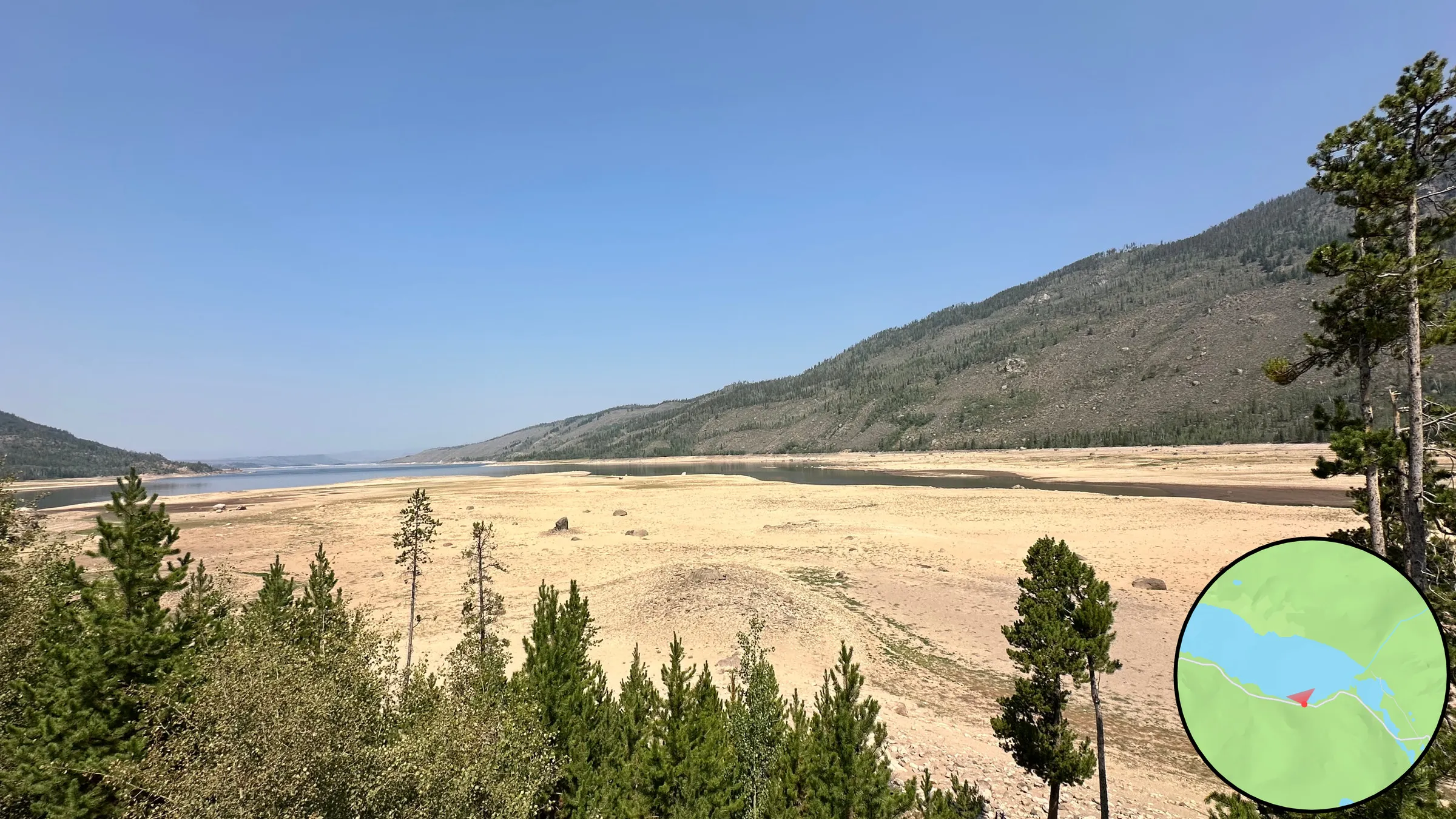
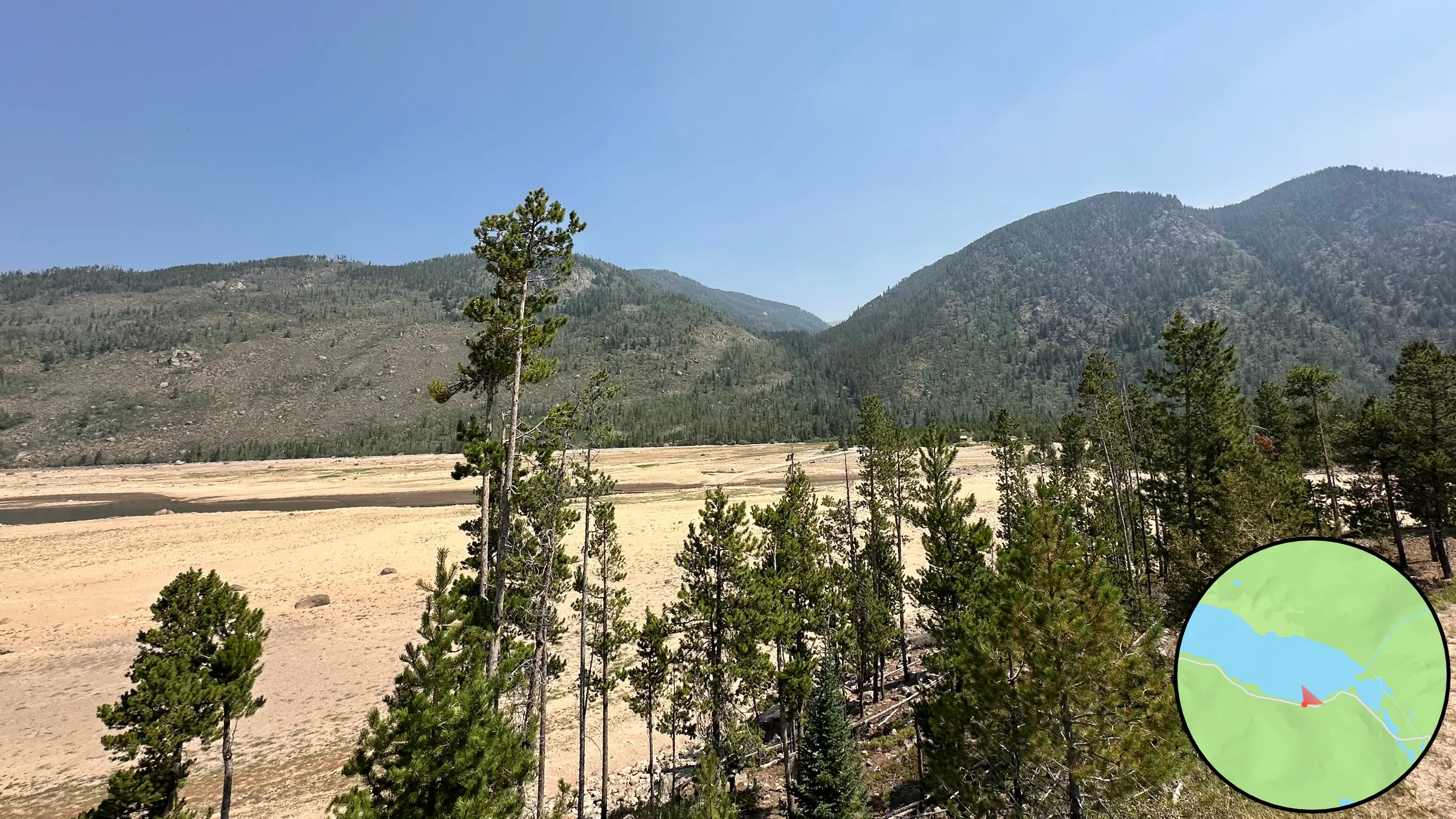
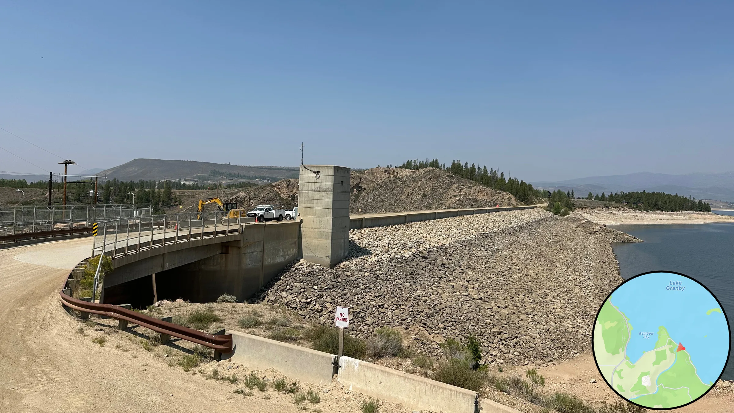
From higher up and at the far end: a pale band of exposed lakebed where the water stood, and the road across the dam.
Beneath Lake Granby
Monarch, built with Claude back at camp to explore the lakebed in context and record findings: it lays a historic USGS topo over satellite imagery, tracks live GPS, cross-fades past and present with a waterline slider, and pins physical remains, with JSON export.
Sitting back at camp, I researched the history of the area and used Claude to build an app that would let me explore the lakebed in context and record my findings. The app overlays a historic USGS topo on satellite imagery, tracks live GPS, has a "waterline" slider that cross-fades past and present, and lets me drop pins on physical remains I find, with JSON export.
Open prototype
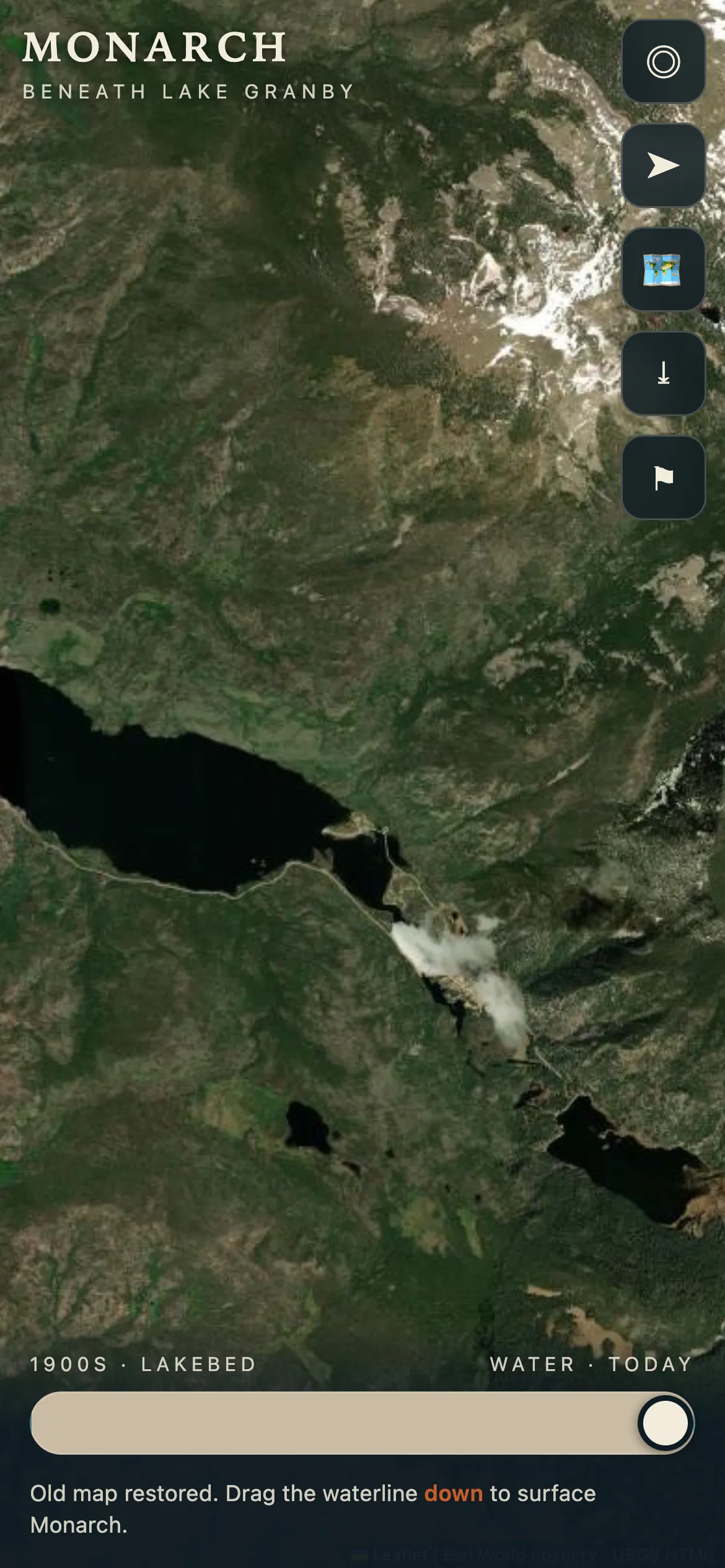
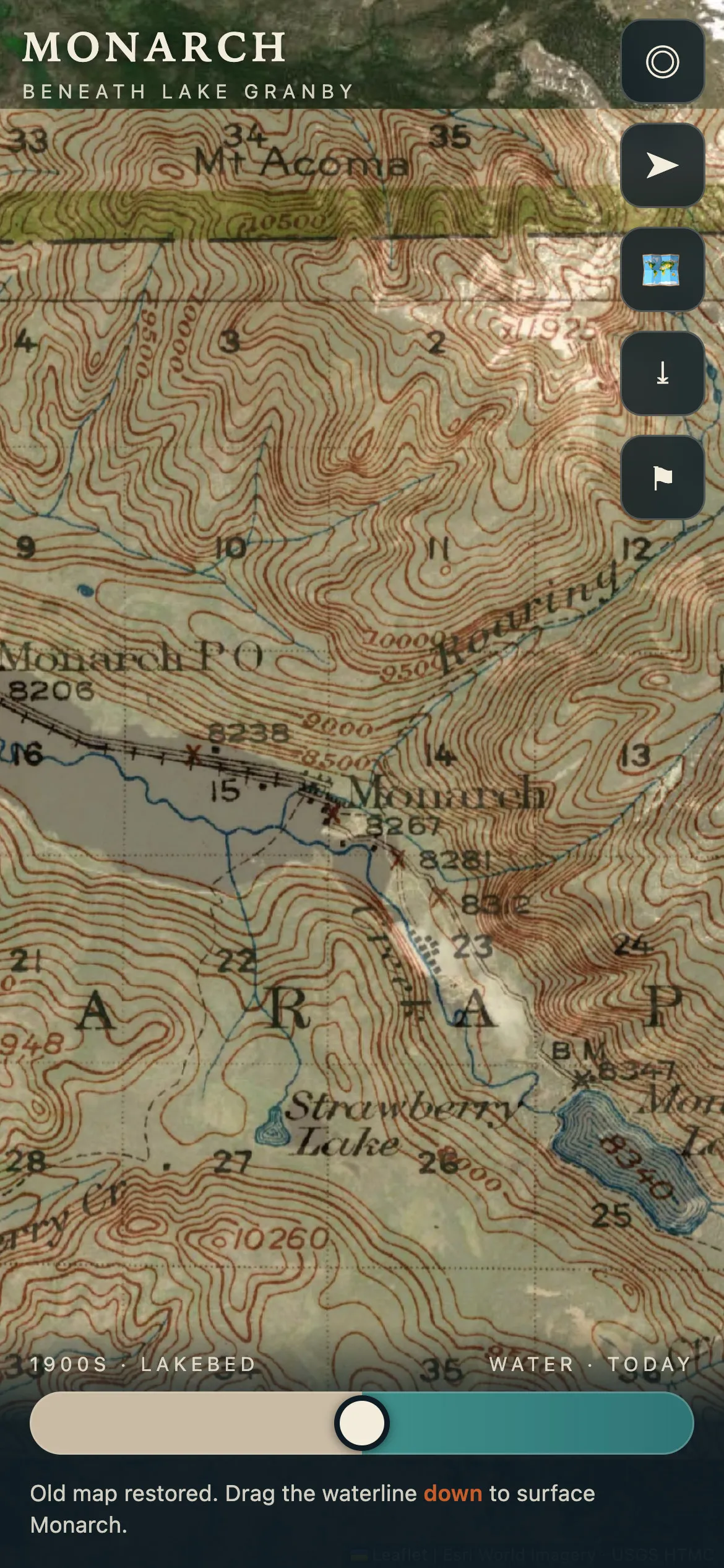
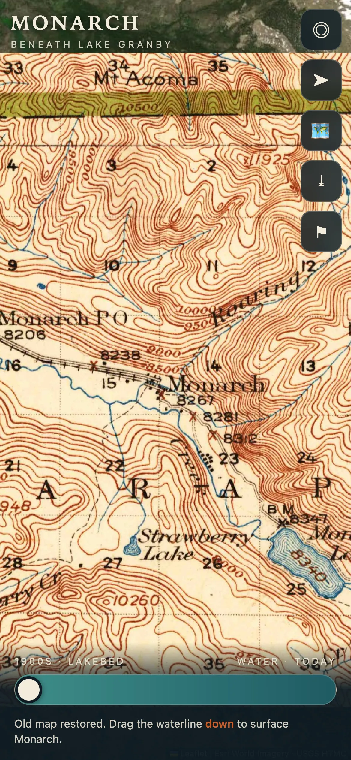
One view of the Arapaho valley at three positions of the app's waterline slider: today's satellite, the two cross-faded, and the 1919 USGS sheet that names Monarch, its railroad and Arapaho Creek. Captured later from the live app, not in the field. Interpreting landscape change here means letting a person move between a place and what it was before the disturbance.
CreditHistoric map: U.S. Geological Survey, Rocky Mountain National Park sheet, 1919. Satellite: Esri World Imagery.
Setting up the app: its first screen with the caveat about drift, the choice of how to bring the old map in, the hand alignment of a sheet over the satellite by drag, pinch and twist, and the sheet for naming a find. Captured later from the live app, not in the field.
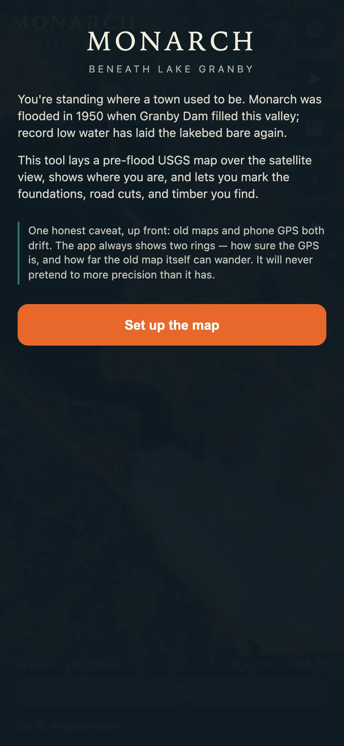
Introduction to the app.
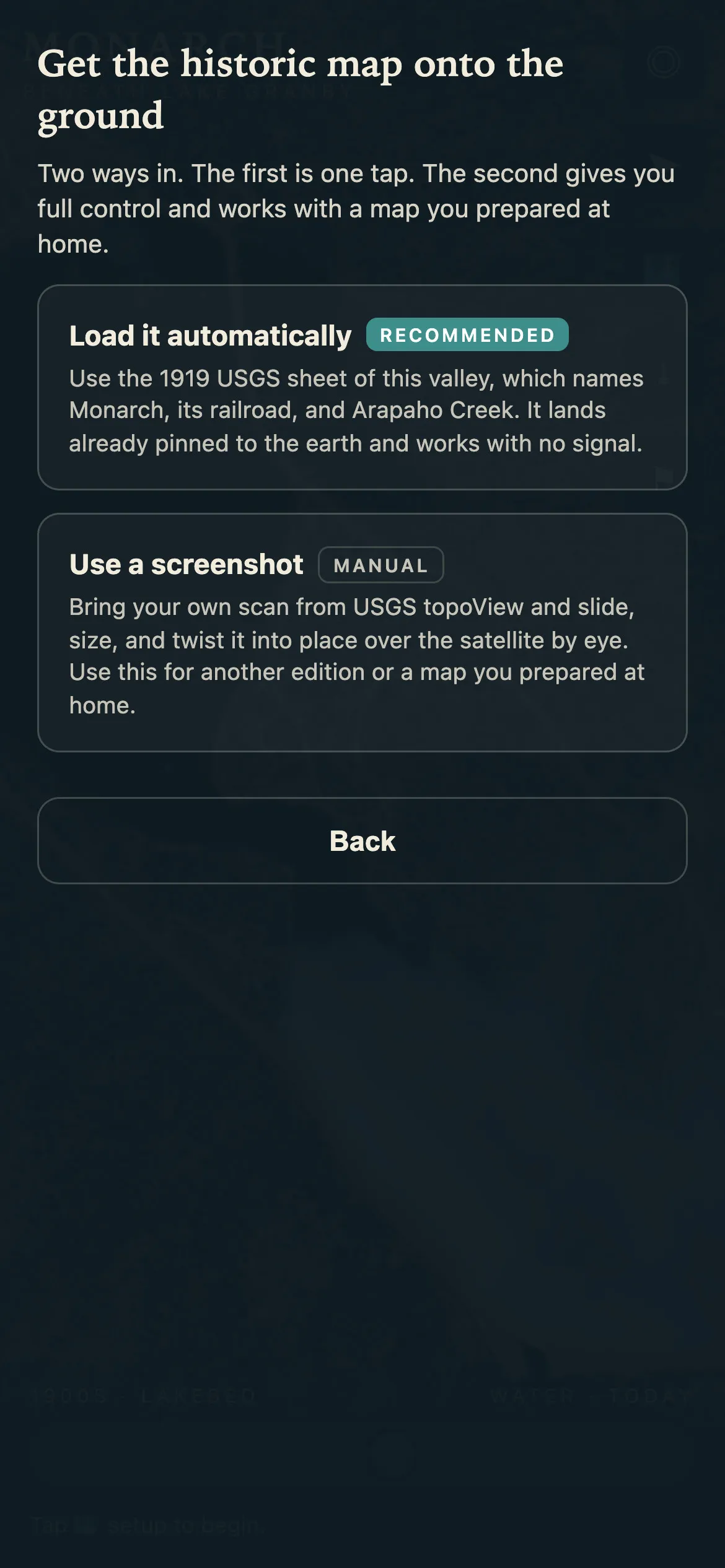
Select the historic map to overlay.
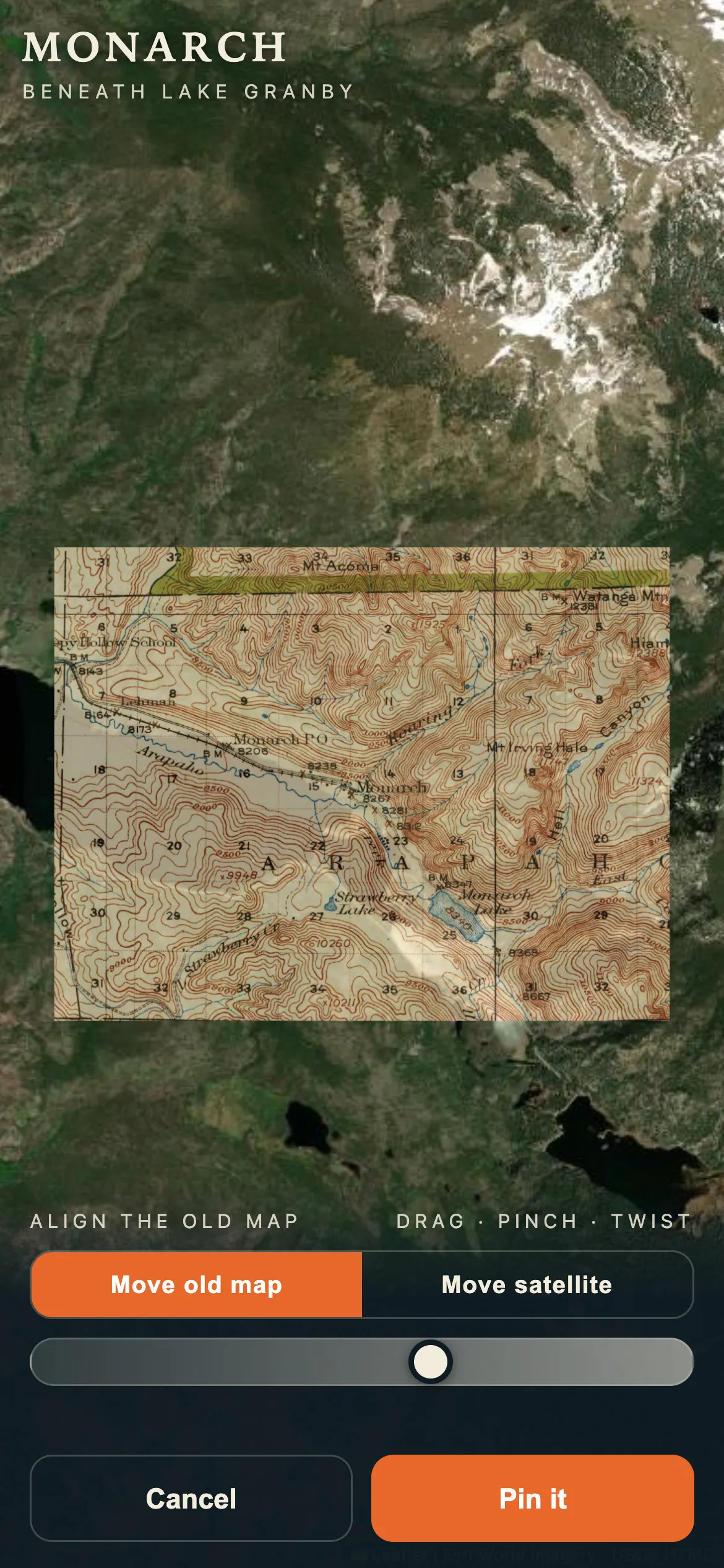
Pin the old and new maps to one another.
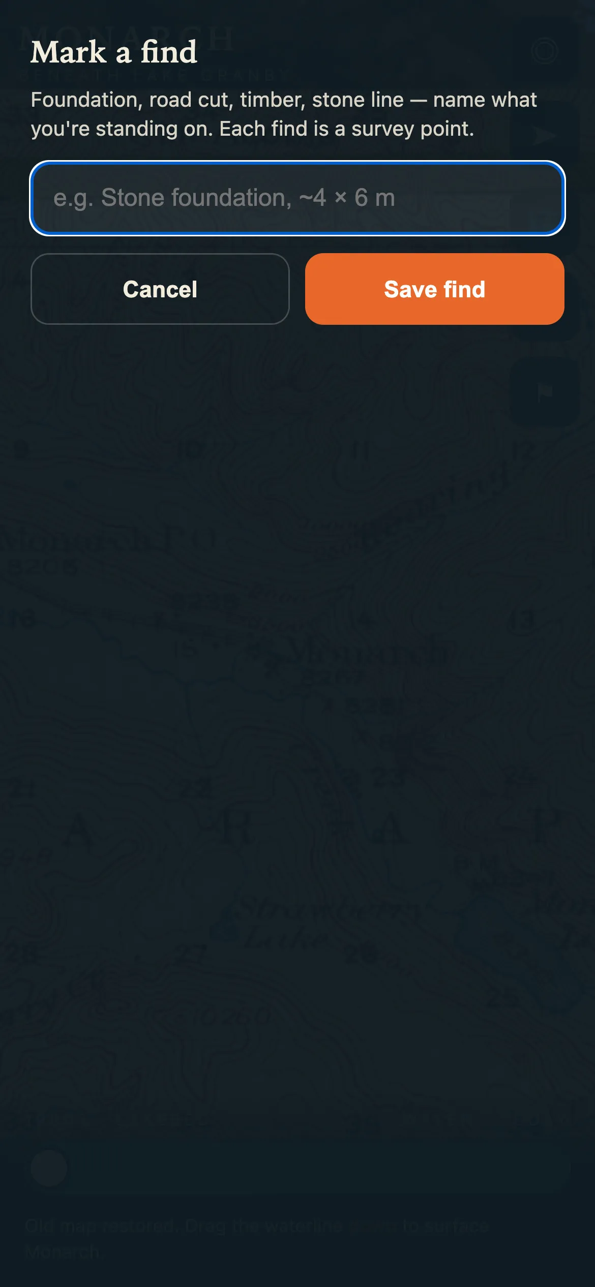
Record the location of interesting finds.
The design principle of the app, honesty about precision: around the position sit two rings, one for how sure the GPS is and a dashed one for how far the old map can wander, which makes it easier to spot correlations between the modern high-resolution map and the historic low-resolution one.
The GPS dot shows two rings, one for GPS accuracy (~5 m) and one for historic map drift (~65 m). This makes it easier to spot potential correlations between the modern high-res map and the historic low-res map.
The survey from the evening of August 6: 17 finds marked on the lakebed between 6:11 and 6:46 pm, among them rock walls, a door, the four corners of a house, a large foundation, wagon wheels, metal rods, and entry sign pylons. Shown as the diamonds and the two rings on the 1919 sheet, the same diamonds on today's satellite, which shows the lake full over the lakebed, and the app's list, its middle rows cut to fit the screen. The finds are real; the position on the first screen is simulated. The app was used where it was built.
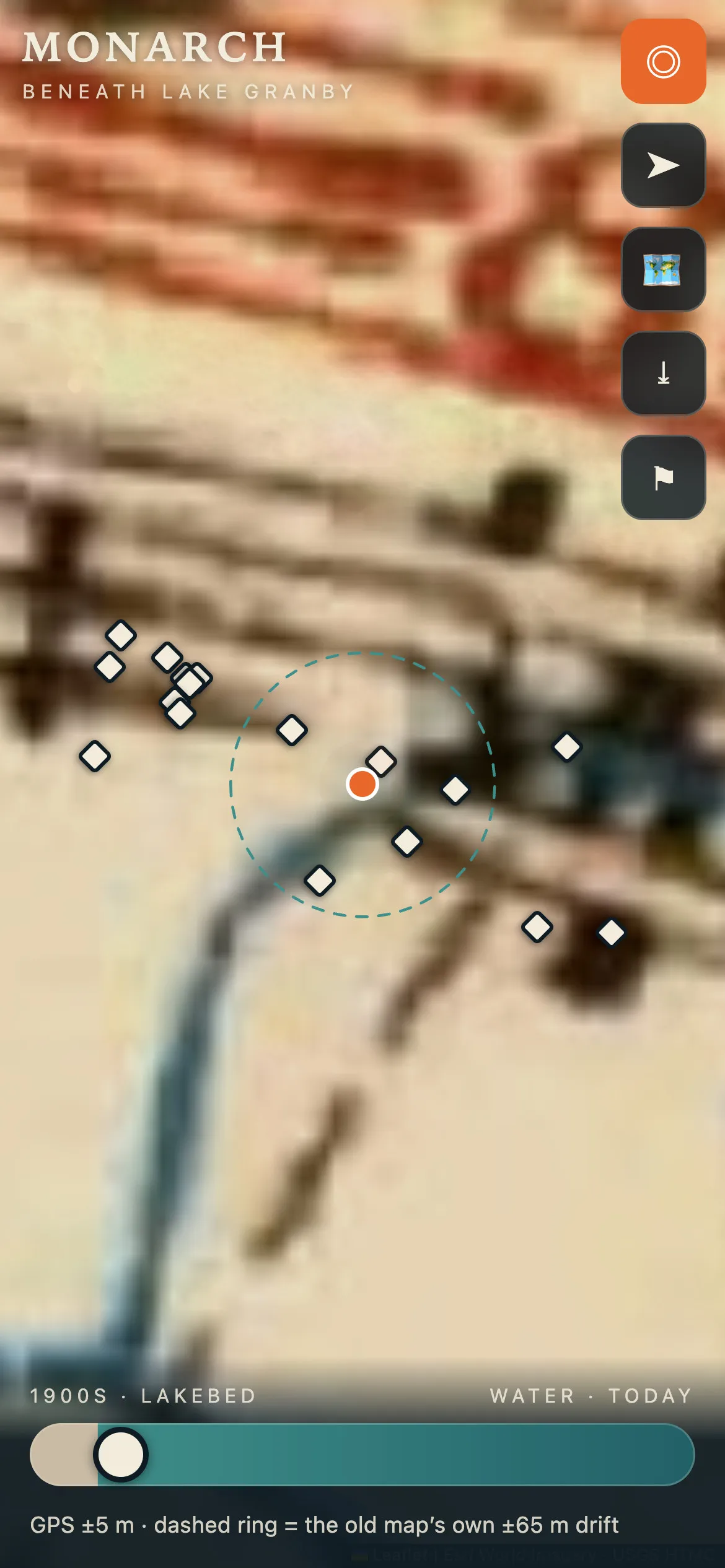
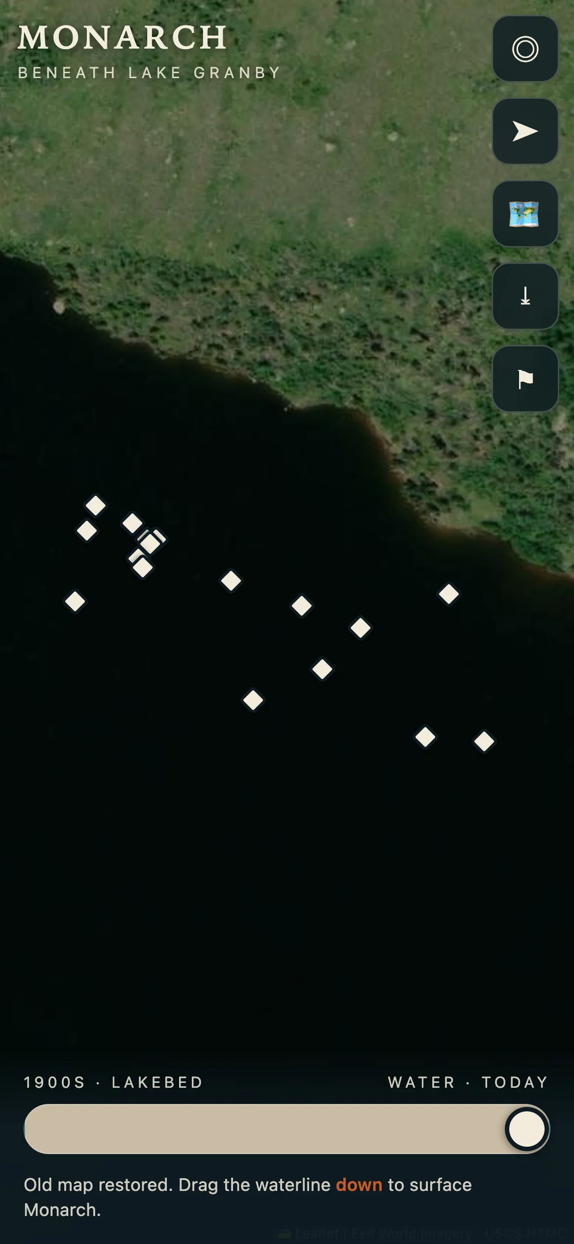
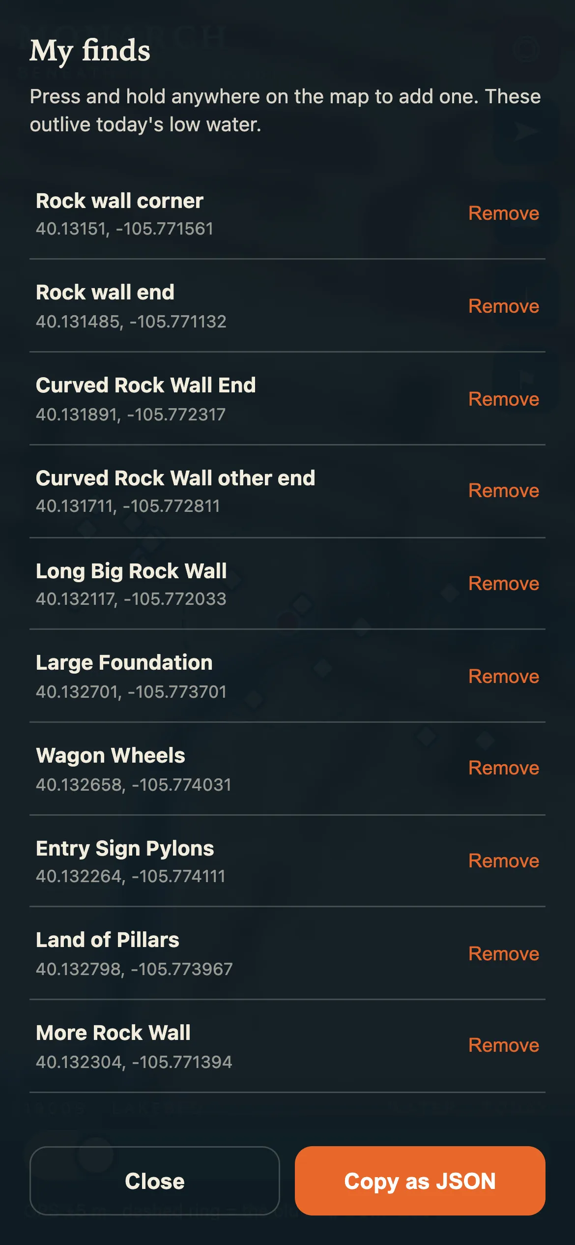
CreditHistoric map: U.S. Geological Survey, Rocky Mountain National Park sheet, 1919. Satellite: Esri World Imagery.
Optimism
Why two Mark Twain quotes close the page: in the face of drought and climate change, the choice of learning, of leading efforts for change, and of optimism, taking inspiration from audacious efforts like the Colorado-Big Thompson Project.
I found two competing Mark Twain quotes that spoke to me in this moment. The optimist who is sometimes wrong is hopeful, and hope leads to change. And knowing too little is an ageless problem, especially if you just turned 49. So in the face of drought and climate change, I choose learning and leading efforts for change. I take inspiration from humanity's audacious efforts like the Colorado-Big Thompson Project and its modern equivalents. I choose optimism.
Two lines from Mark Twain on optimism, side by side, each beneath a photograph of him on a porch. They turn the page from the dry lake to what might follow.
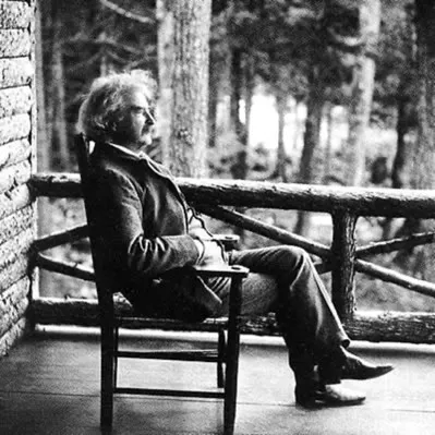
Mark Twain
“It’s better to be an optimist who is sometimes wrong than a pessimist who is always right.”
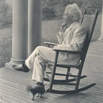
Mark Twain
“The man who is a pessimist before 48 knows too much; if he is an optimist after it, he knows too little.”
Reasons for optimism: a winter forecast of an El Niño wet season, with snow favored over the Southwest, the abundance of renewable resources across the United States, a large solar field, and an old relief drawing of the tunnel under the Continental Divide.
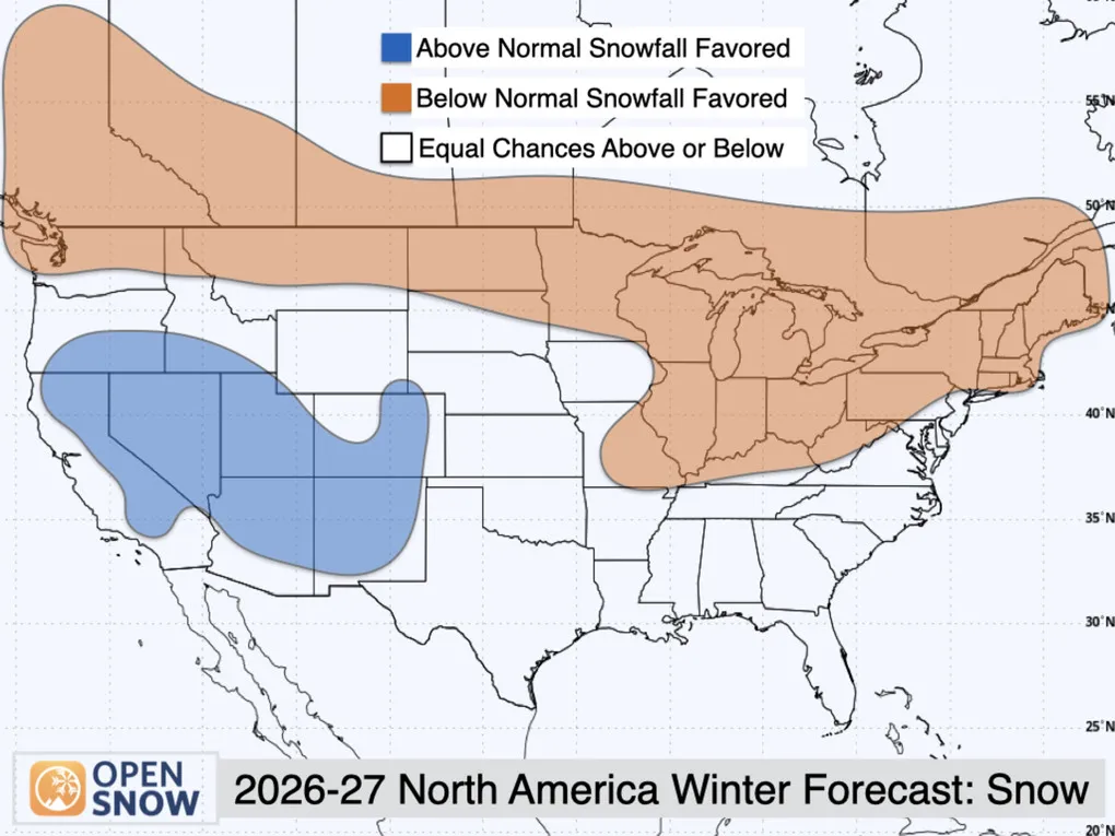
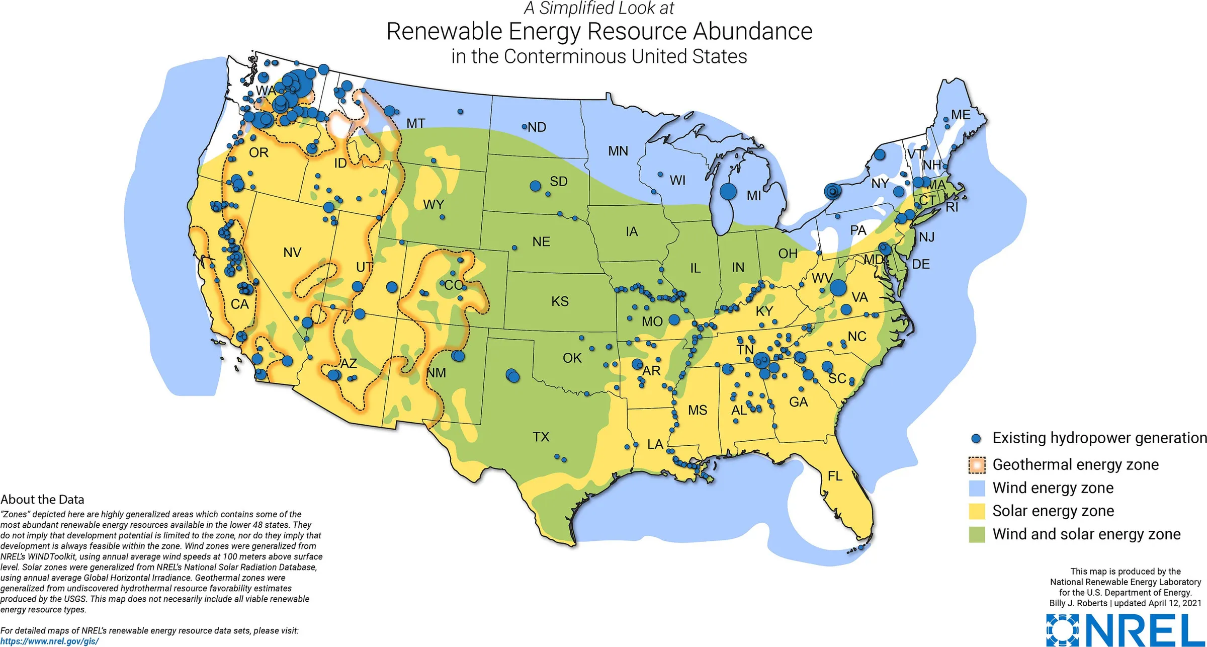
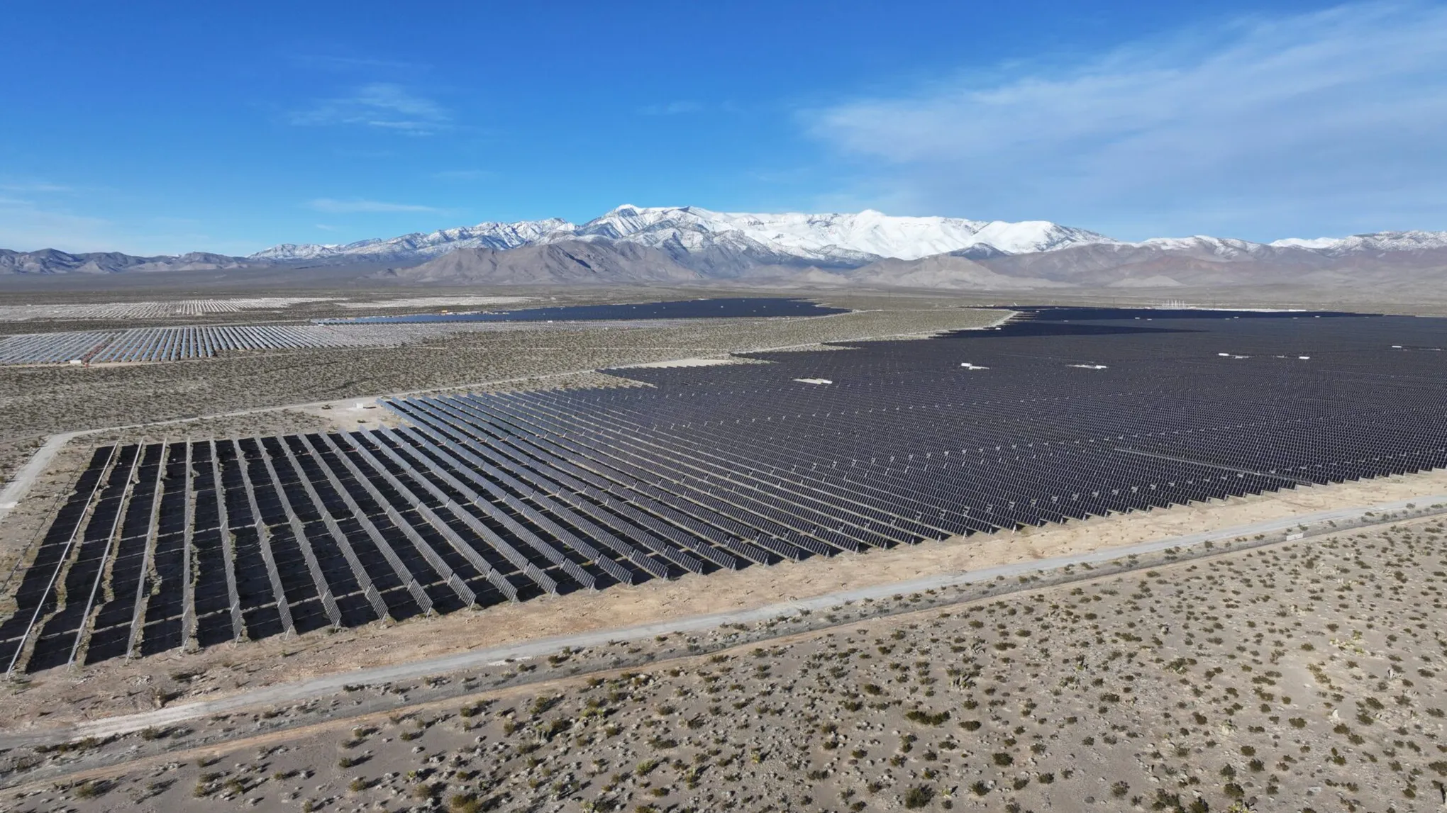
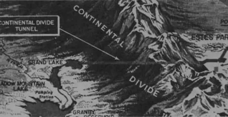
CreditForecast: OpenSnow. Renewable energy map: National Renewable Energy Laboratory.
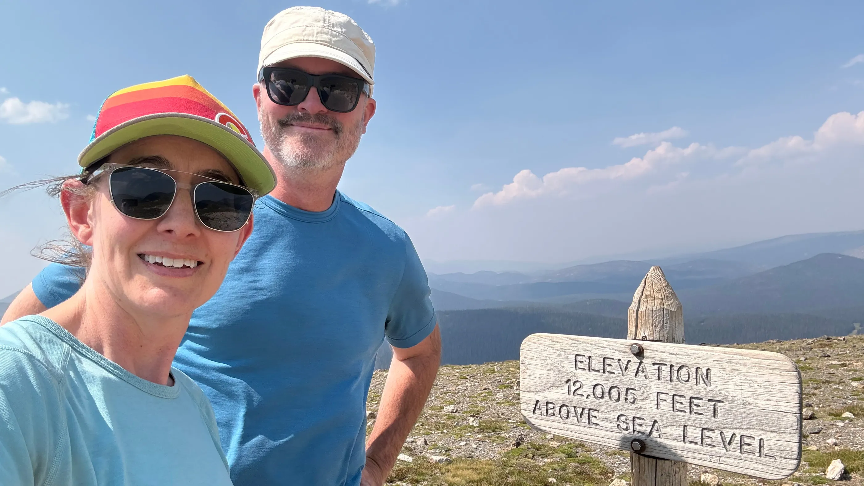
The close: two people smiling in sun hats and glasses at a wooden trail sign reading Elevation 12,005 feet above sea level, on high tundra with haze over the mountains behind.
AI usage
3, Edited. I wrote the draft. AI suggested changes, and I took, refused or rewrote each one.The tiers